 Rendering Ruse: The use of architectural renderings, engineering drawings, or other documents, that are submitted during a planning process to gain favor for a project, and that show or propose important elements (whether treasured, beloved, historic, popular, etc.), or the visibility of such elements, as being preserved or included in the proposal, which are nonetheless gone when the project is completed.
= = = =

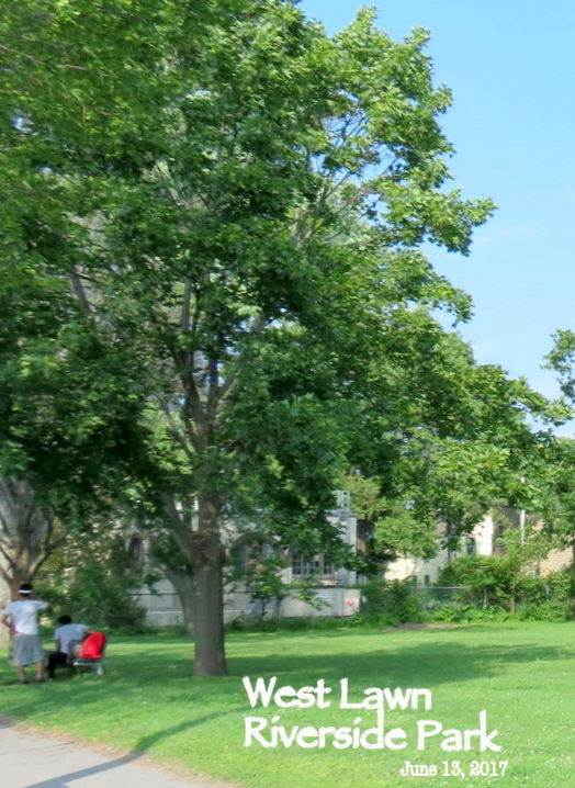
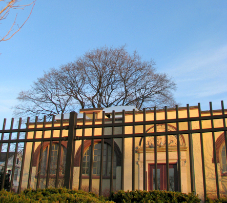
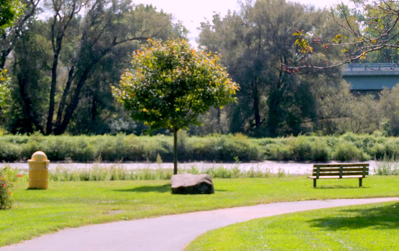
above & below: RENDERINGS of new North Ferry St. Pump Station at Schenectady’s Riverside Park, submitted to the public October 2017. (The grand, hundred-year-old tree marked with a white asterisk by the editor, is preserved in the renderings. Also, the façade of the Old Pump House is visible from the West Lawn.)

ACTUAL
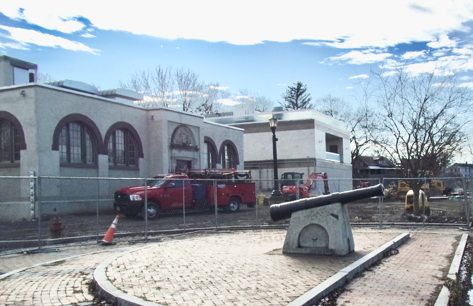
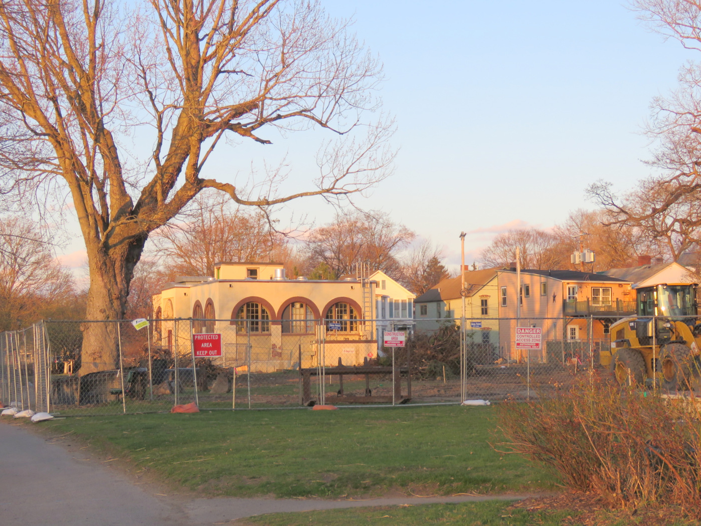
View from the East, December 20, 2021: The façade of the New Pump House has been moved much closer to the River, blocking the formerly expansive view of the West Lawn from east of the Old Pump House.

View from West, Dec. 17, 2021: New Pump Station constructed farther to the north and west than originally depicted. obstructing view of Old Pump House and taking up (“alienating”) more of the West Lawn.

– June 2017

– April 2020
 . .
. .
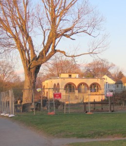
. . Grand Old Tree [above] April 11, 2020; [below] April 22, 2020 . .

– July 28, 2020

. . above: the reinforcement and framing for the underground portion of the New Pump Station make it obvious that the new building will stand significantly north of the Old Pump House, blocking the view of it from the west portion of the Park and when approaching from the west on the Mohawk River . .
. . and see the followup (June 23, 2020): “Conclusions from the June 1st Pump Station Briefing” . .
. . share this post with this shorter URL: https://tinyurl.com/RenderingRuse

INTRODUCTION: The grand old tree that graced the West Lawn of Riverside Park for over a century was chopped down last week on Earth Day 2020, April 22. (Marked with a white asterisk in the two renderings above; 2017 photo on the right.) It was still healthy, with a diameter of 60 inches. Many Stockade residents and Riverside Park lovers where surprised, shocked, saddened. We were sure that significant tree would be preserved in the multi-million dollar pump station project being staged currently at the Park. We did know that a few “lesser” trees along the pump station’s original fence did need to come down to fit a new pump station on the lot of the old pump house. As would be expected, those lesser trees do not appear in the 2017 renderings, which are meant to show what a site will look like after the proposed construction is completed.
 . . “surprise” May 2019 Plan . We sought explanations. In an email on April 27, 2020, to Stockade Association President Suzanne Unger, we were given “answers” by the CHA Project Engineer for the New North Ferry Street Pump Station project, Mike Miller. Mr Miller answered questions from Stockade resident Emmanuel Maillet, whose backyard borders on that part of the Park. Miller wrote that the conclusion the Grand Old Tree needed to be removed was made at the time the City asked the engineers to put the new pump station on the old lot, rather than their proposal to put it on the Park’s beautiful West Lawn. Miller added that its removal was included in the “final plans” they developed in May 2019 (click on image at head of this paragraph):
[Q] When did it first become clear that the [huge old tree in Riverside Park] had to go? [A] Removal of the tree was first determined to be necessary when the City was requested to build the new facility adjacent to the existing pump house. Provisions for removal of the tree were included in final plans that were developed for the Project, dated 5/14/19.
But the City’s request to move the needed pump station was made months before the above renderings showing the Grand Tree were presented in October 2017 to the City and the public. Those renderings did not reflect the actual (and apparently anticipated) fate of the beloved tree, but the public was not told and did not know that.
- Mike Miller noted in a phone call with Emmanuel Maillet that the project architect put the tree in the renderings. We’ve heard nothing from the architect on this issue.
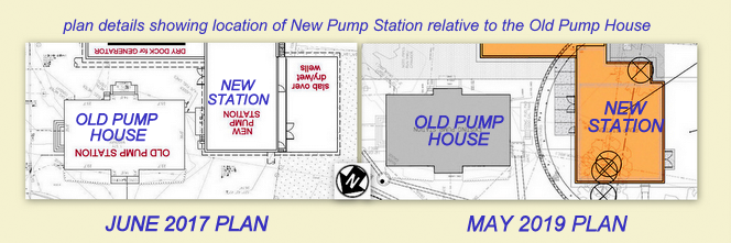
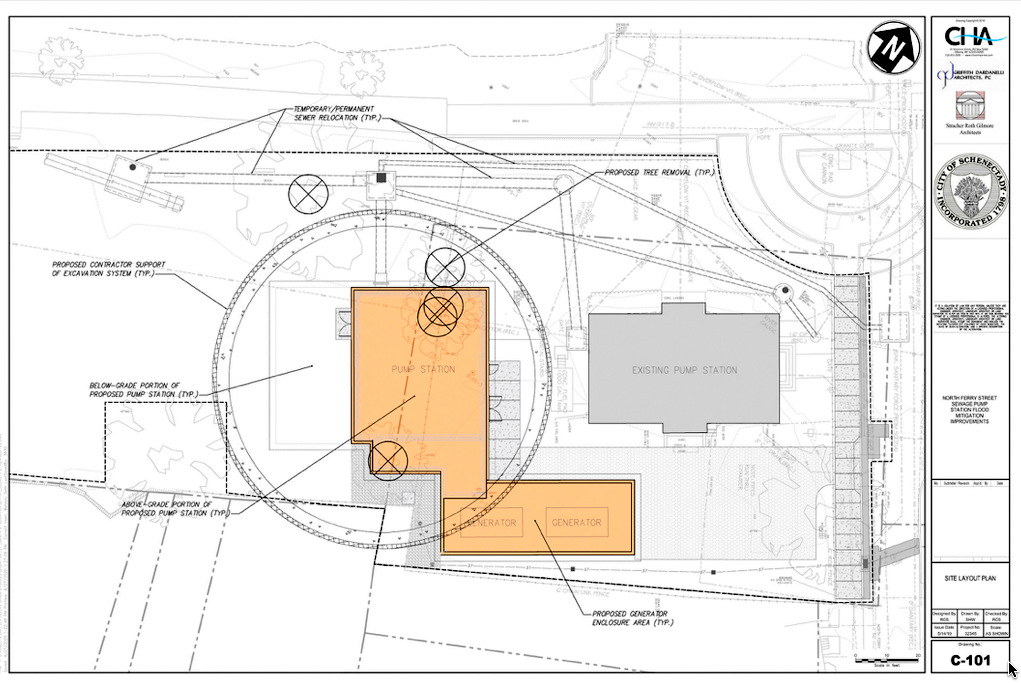
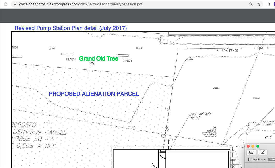
 More to the point, no one in the Stockade community, including the Board of the Stockade Association, had ever heard of a 3rd/Final Pump Station Plan. [As of May 15, 2020, you will still not find it on the Association’s Pump Station Documents Page.] The May 2019 plat shows the Pump Station moved perhaps 20 feet to the north and west of the October 2017 version, thus purportedly necessitating the removal of the Grand Old Tree and completely blocking view of the Old Pump House from the west. The “secret” May 2019 plan, which we never knew about, did indeed indicate the Tree’s removal (as I have noted in red on the image to the right of this paragraph, which compares the May 2019 plan to the last public plan in October 2017; click on the collage for a larger version).
- CONSTANT COMMUNICATION. When asked recently about the apparent failure of those responsible for the Pump Station Project to notify residents of the Stockade or its Association, both Mayor Gary McCarthy and Director of Operations Paul Lafond have mentioned that there has been constant communication with the Stockade Association officials over the past year. This is a true but misleading statement. It is telling, on the other hand, that Paul Lafond and Gary McCarthy both attended the 2019 Stockade Association Annual Meeting, which took place on May 16, 2019, just two days after the date of the May 2019 “final plan.” Nonetheless, according to Carol DeLaMater, who was SA president at the time, “There was no update from city on changes to site plan presented to HUD by GOSR on city’s behalf for CDBG-DR funding”. Of course, notice of important changes should be made before, not after (and certainly not a year after) promulgating a final plan revising a public Plan approved by the City Council and supported by the public.
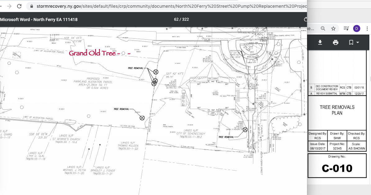
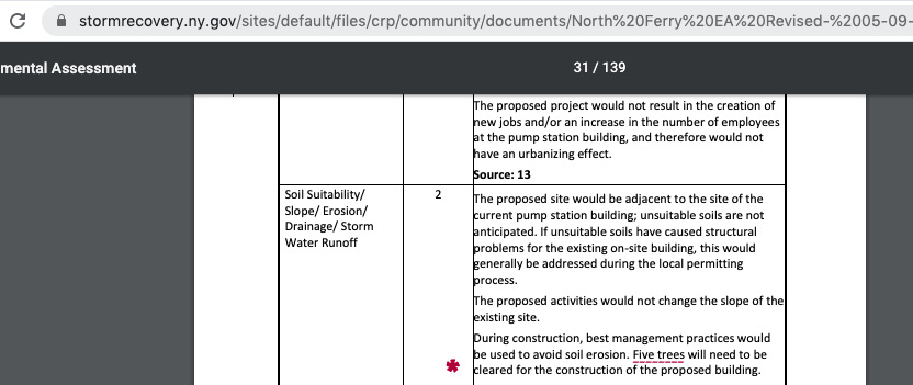
 The Tree Removals Plan submitted by the City for the initial Environmental Assessment in Nov. 2018 (at 62), showed five trees being removed, but did not include the Grand Old Tree as one of them (click on the annotated thumbnail image to the left). In the May 9, 2019 revised Environmental Report (at 31), the removal of five trees was again indicated on the submission (with no blue ink to show a change), but the large tree that had already been removed to the east of the Old Pump House was no longer on the plat. Thus, the “five trees” for removal now included the Grand Old Tree, but the text was not changed to show it was actually a 6th tree that would be removed for this Project. See the annotated screenshot immediately below.

Blocked View of the Old Pump House Façade

. . the secret May 2019 plan would block views of the Old Pump House façade from the west, by placing the front face of the New Station closer to the River than the Old Pump House . .
 Another very important change in the May 2019 Plan is the moving of the new station to the north (closer to the River) so that it significantly blocks the view of the picturesque and beloved Old Pump House from the west. (The image to the right shows the last public renderings from October 2017, with the new station set back to keep the façade of the Old Pump House and a west-facing arched window in view from the west.) In an environmental impact assessment, obstructing the view of a Historic Resource or District is deemed an adverse impact that must be removed or mitigated. [see NYS Department of Environmental Conservation Visual Impact Assessment Policy (2000)] We were never told about, and so were not able to contest, what would be an irreversible loss if the May 2019 Plan is followed.
 - The State Historic Preservation Office [SHPO] okayed the October 2017 location and footprint of the project, based on the then-existing “site plan”, drawings and renderings for the project. However, it appears that SHPO never considered the new location of the Pump Station for the final GOSR Environmental Assessment (May 9, 2019) of the North Ferry St. Pump Station, which included no new renderings or sketches, but has a cover image that continues to show the new station set back south of the façade of the Old Pump House.
But, who knew such a plan existed?
The following statement from the April 2020 Stockade Spy (at 2) presents comments of Mike Miller to the Stockade Association and does not mention a May 2019 Final Plan:
According to Mike Miller from CHA Inc, the proposed design for the pump station (e.g., building footprint or elevation) has not changed since it was presented for public input in fall of 2017. The layout for the pump station requires that the average encroachment into the park (along the west parcel line) be less than 30 -feet, per the parkland alienation legislative language. Based on the survey for the existing pump station parcel, the current layout results in an average encroachment beyond the pump station lot of just under 28-feet. The north fence line along the river will be relocated closer to the pump station, resulting in more accessible park land which can be utilized by the public. This results in negligible loss of lands for public use within Riverside Park.
After seeing the May 14, 2019 “final” Plan sent by Mr. Miller to SA President Suzanne Unger, I have to conclude that his statement to the Spy for the April edition seems to be crafted to be reassuring and to deter probing questions, but in doing so was highly misleading. Mr. Miller’s standard that the “average encroachment into the park be less than 30 feet,” misstates the City Council’s clarifying resolution, which clearly states that “any overflow into Riverside Park will be minimized to no wider than 30 feet, including needed landscaping and buffering for a new pump station.” It goes on the resolve that:
“without a full public hearing on such design, the City Council shall approve no contract for the construction of a new pump station, and no construction shall be approved if the design requires taking a portion of parkland extending more than 30 ft. to the west of the current pumping station fence into Riverside Park.”
.
Mr. Miller may be correct that the footprint and elevation, and outward design, of the Pump Station had not changed in the 2019 Plan. (Actually, the facility appears to be larger in the 2019 Plan, as the Old Pump House is the same size in each drawing.) But, the location has been shifted north and west, resulting in an encroachment of more than 30’ into the Park and condemning the Grand Old Tree. His assertion that “average encroachment beyond the pump station lot [is] just under 28-feet,” is surely strong evidence that the encroachment is more than the allowed 30 feet in some places. Yet, we were never given the chance, and apparently neither was the City Council, to question that Plan and suggest alternatives.
.

Riggi: Hold your feet to the fire.
- Note (May 7, 2020): I’ve been trying to find out whether the May 14, 2019 plat (also shown in the plan-comparison collage above) was ever brought to the attention of City Council, which passed a special Clarifying Resolution in June 2017, Res. 2017-179, requiring a public hearing before approving any plan for the Pump Station protruding into the Park more than 30 feet from the original fence. See “what the Parkland Alienation Resolutions mean” (June 13, 2017), at our sister website “Suns along the Mohawk”. update: (May 19, 2020): City Council member Marion Porterfield, after receiving email from Emmanuel Maillet and David Giacalone asking whether the Council had ever seen the May 2019 Plan, put the issue on the Council Agenda for its May 18, 2020 Committees Meeting. The Mayor assured her she would get a reply within a few days from the relevant City officials. We await her findings.
- update (May 28, 2020): City Council now plans to have a Pump Station Briefing by relevant officials at its June 1, 2020 Committees Meeting, which will be held “remotely” by teleconference. Click for the Agenda. Join by Phone: 1-415-655-0001; WebEx Access Code: 161 708 6723; Meeting Password: E7HjBk9HSu2
- Former Council Member Vince Riggi wanted no portion of the Park alienated for the Pump Station, and voted No on the Alienation Resolution. Vince did, however, vote Yes on the Clarifying Parkland Preservation Resolution, warning his colleagues that he would “hold their feet to the fire” to assure the Mayor and Council enforced the Clarifying Resolution’s 30′ maximum intrusion into the Park. When I asked Vince Riggi on May 4 if he recalls ever having the May 2019 Plan submitted to City Council, he wrote right back:
“I do not and I’m sure that is something I would not forget.
.
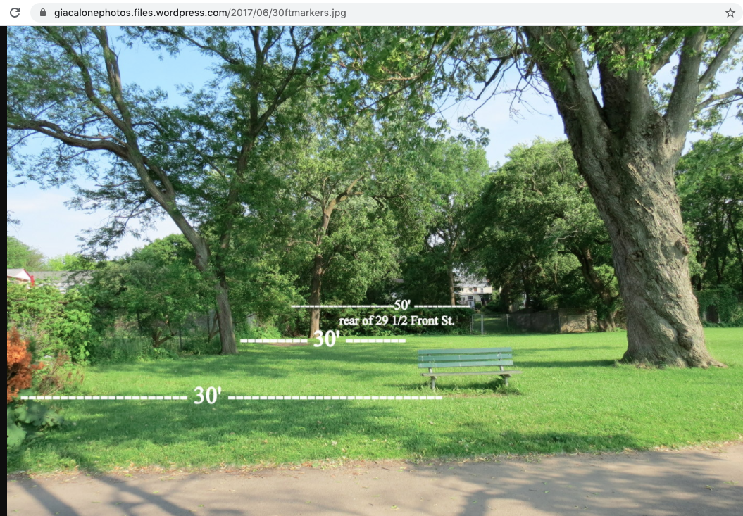
 In addition, bolstering our expectation that the tree would be preserved, a plat of the project site submitted to the City in July 2017 showed the Grand Old Tree outside of the portion of parkland the City wanted to alienate to accommodate the new pump station. Click on the annotated detail to the right.
- Moreover, the Old Tree stood well outside the 30-foot distance from the original fence that City Council requested not be exceeded without a public hearing on any further impingement into the Park. Measurements taken by myself and a neighbor in 2017 are seen in the photo immediately below. [At the bottom of our prior posting, you can read City Council’s June 12, 2017 Resolution, Res. 2017-179, with its stated intent to preserve Riverside Park parkland.]

.
YES, ANOTHER RENDERING RUSE. Taking all of the above into consideration, and receiving no contrary claims from proponents of the new pump station, it is very difficult to avoid the conclusion that the City Council, Stockade, and general public are the victims of a Rendering Ruse. “What’s that?”, you ask. This is my definition:
Rendering Ruse: The use of architectural renderings, engineering drawings, or other documents, that are submitted during a planning process to gain favor for a project, and that show or propose important elements (whether treasured, beloved, historic, popular, etc.), or the visibility of such elements, as being preserved or included in the proposal that are nonetheless gone when the project is completed.
The compromise leading to the June 12, 2017 Clarifying Resolution was praised by the pleasantly surprised Gazette Editorial Board (June 16, 2017). The editorial nonetheless cautions:
“opponents will still need to maintain the pressure to ensure the city keeps its pledges, including speaking out at the promised public hearing on any new design proposal.”
Clearly, we were not sufficiently vigilant, and were too trusting of a City Hall that has in no way earned that trust when it come to preservation in the face of “progress.”
. . click the collage thumbnails below to see more of the Grand Old Tree and its fate . .
 . .
. . 
 (update: May 15, 2020): WHAT’s the STOCKADE ASSOCIATION DOING about this? The members of the Stockade Association [“SA”] are rarely asked their opinion on any topic. Instead, the SA Board normally acts on its own, without a significant attempt to ascertain what its members and others in the Stockade neighborhood and community would like to see done.*/ My subjective opinion, admittedly seen from the outside, is that the primary objective of the Association’s Board and Officers most often seems to be not upsetting City Hall, which has frequently been referred to as “Our Partner in Progress” by the Spy, SA’s official newsletter.
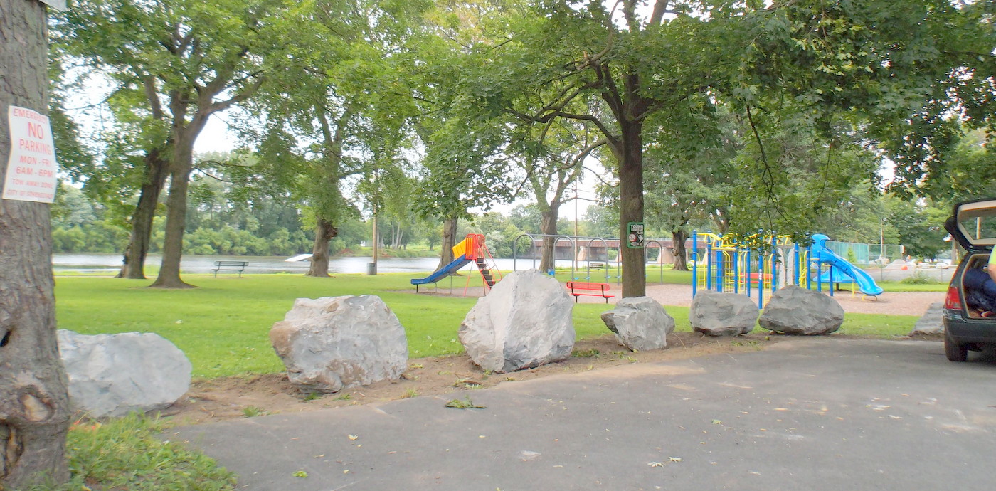
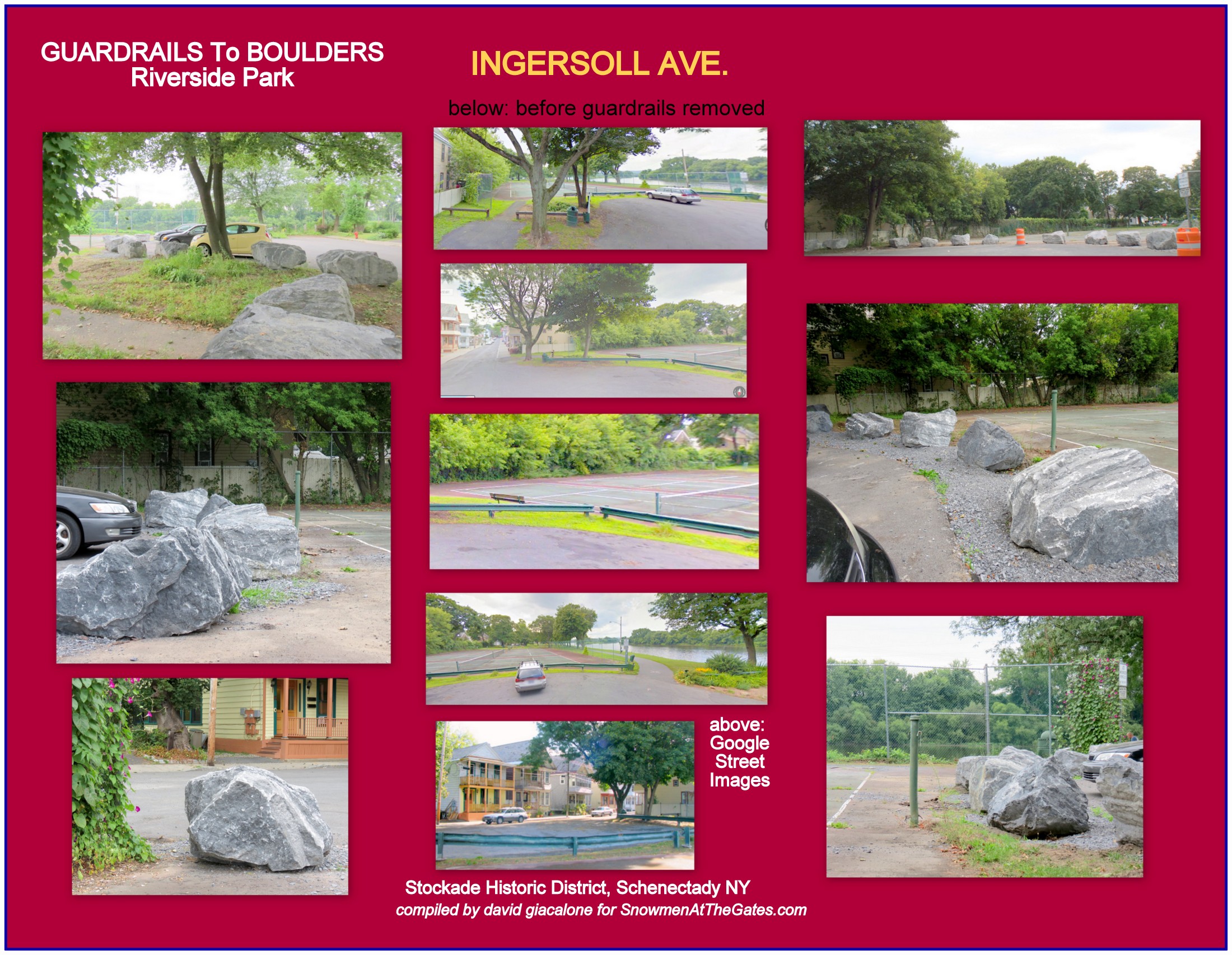
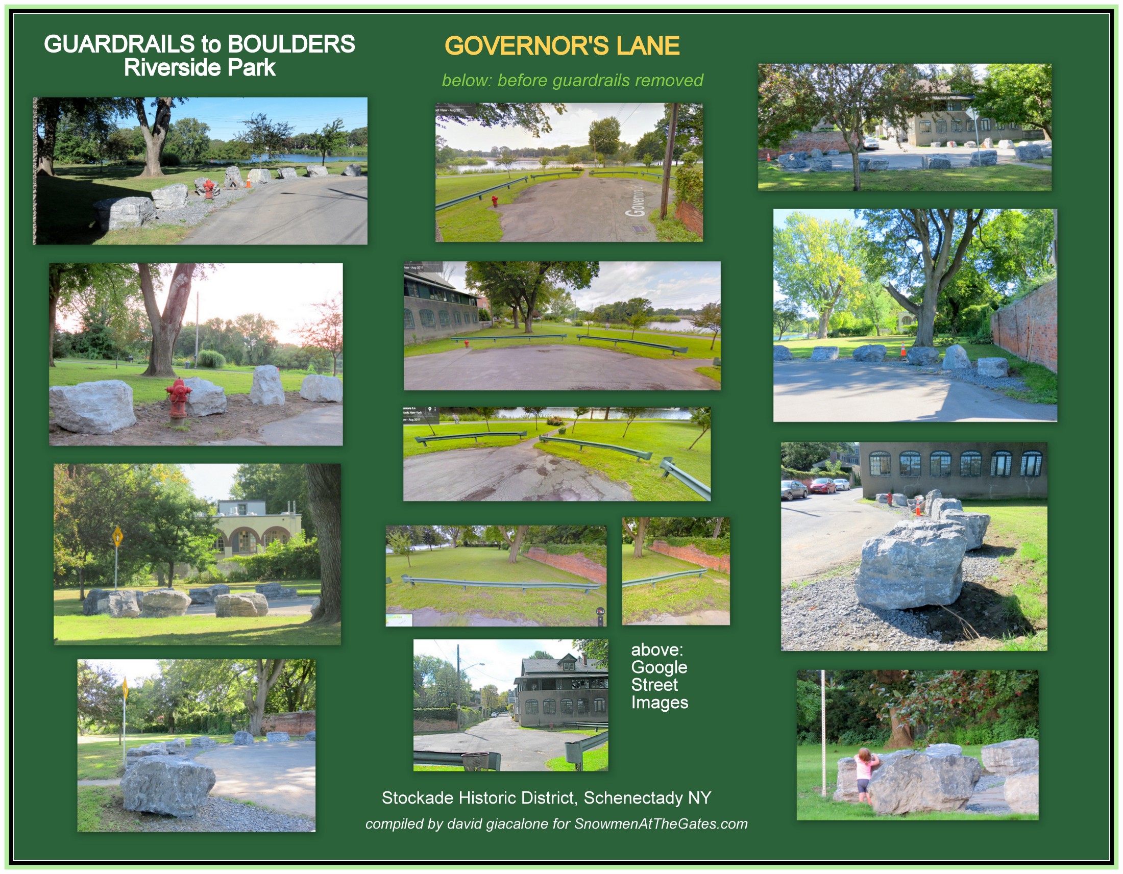
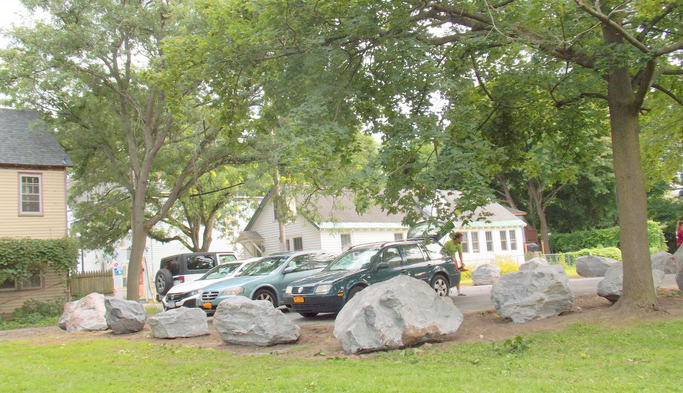
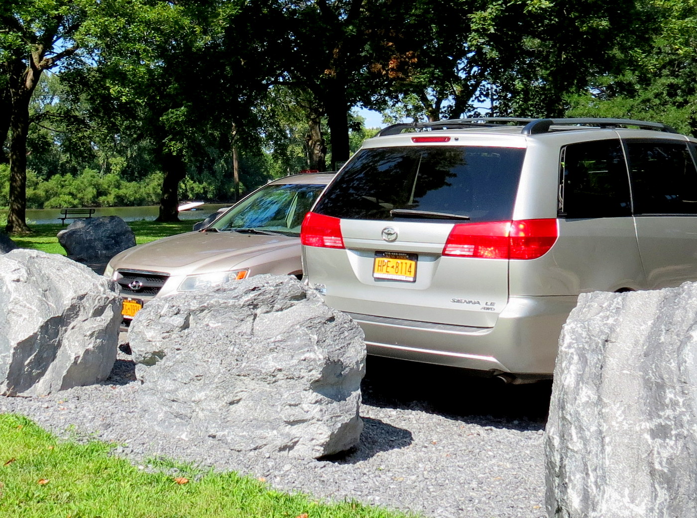
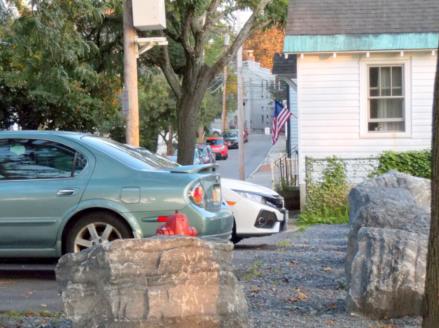
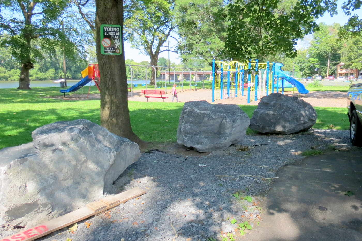
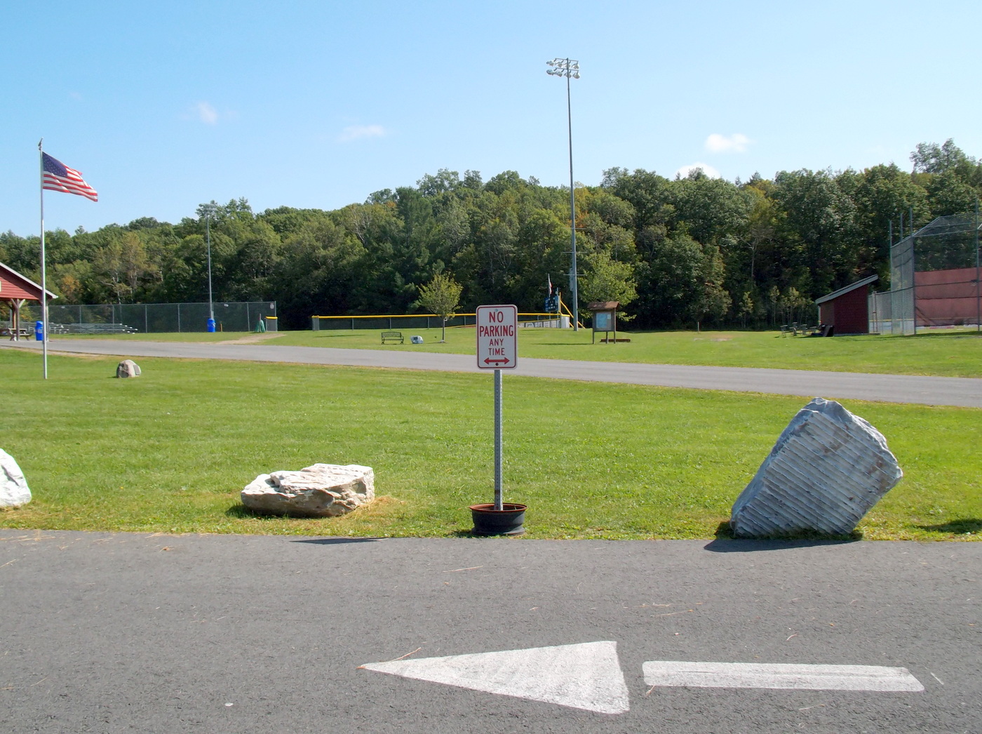
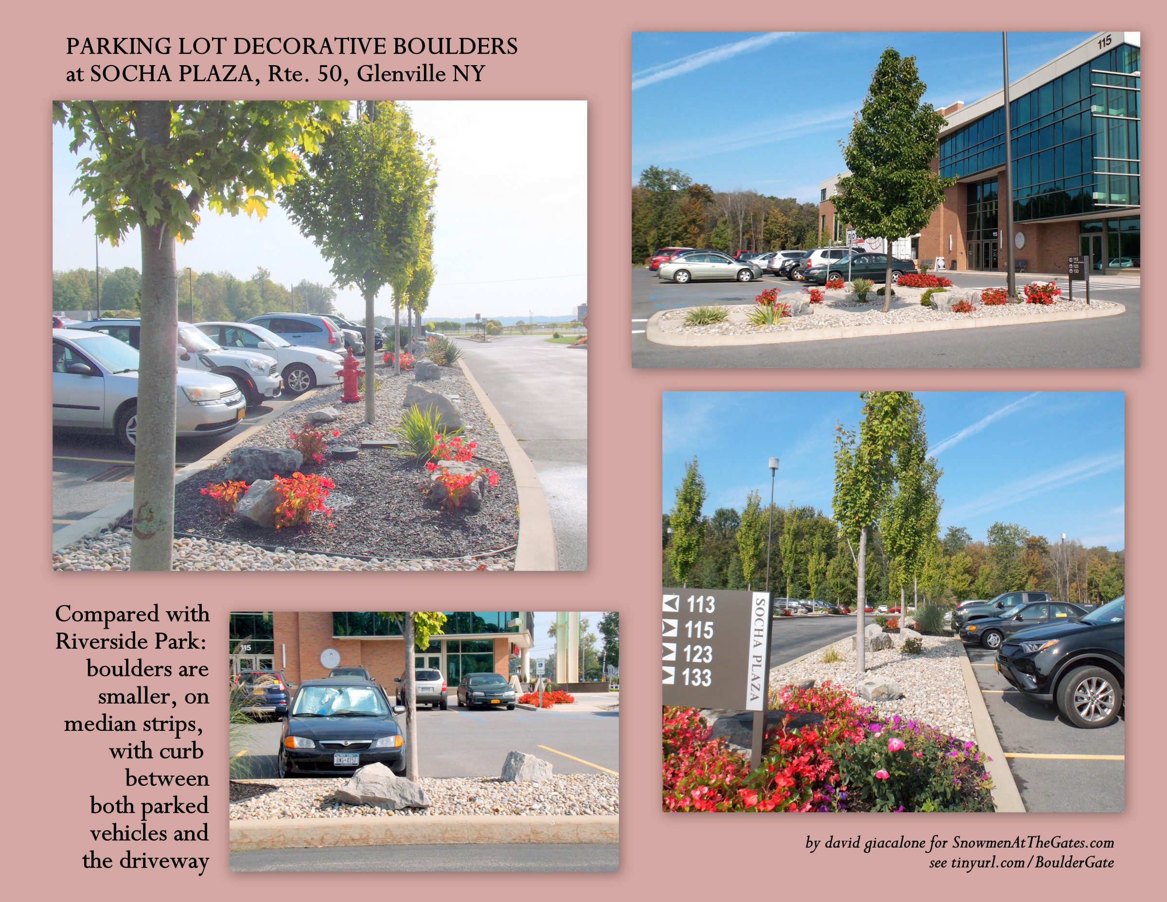
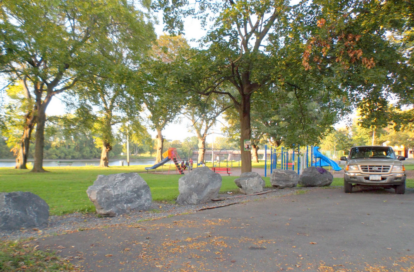
*/ Thus, e.g., Board members waited months before being embarrassed into notifying the neighborhood and fighting placement of a Pump Station on the West Lawn, which would have greatly harmed the Park; it was almost too late, but the SA and community acted with one, effective voice once finally roused (proving that strong advocacy can indeed work). In prior years, without first canvassing its members, (1) the then-sitting Board told City Hall that there was no opposition to a 300-foot dock at Riverside Park (although, once allowed to voice their opinion, the neighborhood voted two to one against a dock); (2) Refused to even put the Casino application on the SA meeting agenda (although the Stockade election district had voted less than a year before against having any commercial casinos upstate). Indeed, before there even was a Casino Application from Schenectady, the sitting SA President (an appointee and supporter of Schenectady’s Mayor) told the Gazette a casino would be a very good thing and she could see no negatives for the Stockade; (3) Welcomed giant boulders at the end of each street along the Park; And, (4) were the only neighborhood association to support John Polimeni’s disastrous Sidewalk Assessment District Plan.
Here, the Board did not first engage the community in a conversation when faced with some serious questions from a number of residents about how the Grand Old Tree could be removed despite the renderings displayed in the last public plan, and why the Board failed to know about the May 2019 Plan, despite dozens of communications between the project leaders and SA officers. Instead, it composed and sent a Letter to the Mayor and City Council, dated May 8, 2020, which was sent by email to SA members but not to the far larger Listserve of Stockade residents and supporters, where the questions about the Earth Day tree removal and the secret surprise Plan had been raised. The Letter from the Board to City Hall:
-
 called the communications problems “a snag”
- assured Mayor and Council they did not think there was any “bait-n-switch” despite the claims of some residents
- pointed out that the public could have viewed the “plan” at City Hall [despite not knowing about it];
- concluded that the overflow of more than 30 ft. into Riverside Park was consistent with the Council’s Clarifying Resolution, because it was underground, not above ground [rebutted in this email from David Giacalone]; and
-
noted that not telling the Association about the changes until last month was “a missed opportunity”: “If we had been told a year ago, we could have prepared residents for this change, pointed out to them that trees would be lost and given them some time to process the information.”
Of course, significant changes to an approved plan should be made public to give City Council, nearby residents, and other interested persons the opportunity to review them, raise concerns, and offer alternatives, and not so their “representatives” on the Board can prepare them emotionally for the negative effects. The “opportunity missed” by the Pumping Station engineers and proponents was the chance to respond a year ago to questions about the changes, and if facts and reasoning supported the changes, to thereby quell dissent.
 update (May 30, 2020): Justifications given by a contractor for a significant change need to be evaluated and tested. For example, earlier this week, CHA engineer Miller told Emmanuel Maillet that the new pump station had to be located further north and west than in the October 2017 Plan, because the contractor could not get permission to stage construction along a strip of land belonging to the first house to the south of the lot., 125 No. Ferry Street. The owner of that house wrote a letter to the Gazette Editor, published on July 6, 2017, strongly opposed to the new location on the old pump station lot. Her unwillingness to cooperate should have been known long before May 2019. A number of observers believe that there were other options readily available at the site for staging that portion of the construction. Such options could have been considered, along with any added cost in dollars and time, in an attempt to mitigate the adverse impact of the May 2019 change in location. If the Council acts quickly, and finds insufficient justification for the changes in the May 2019 plan, it may not be too late to revert to the approved October 2017 Plan.
The proprietor of this website wrote an email to Stockade Association President Suzanne Unger on the day their Letter to City Hall was written, May 8th, only having seen it because an SA member immediately forwarded the Letter to the Stockade Yahoo Listserve. It has been a full week (Friday, evening, May 15, 2020), and SA President Unger has not responded in any way to my email and questions. (update: still no reply as of June 8, 2020) As the person who wrote the first draft of the Clarifying Resolution, and for many other reasons, I believe the May 2019 Plan violated that Resolution. I won’t go through my points again here, but urge you to read my email to Suzy Unger, if interested.
- Click to see the SA Board’s May 6, 2020 Resolution explaining their conclusions, and authorizing the May 8 Letter to City Hall. “Whereas” clauses in the Board Resolution twice use the phrase “building overflow”, saying its use in the Council’s Clarifying Resolution, Res. 2017-179, supports the conclusion that the 30-foot restriction on encroachment only applies to above-ground buildings. The word “building” does not appear in that final version of the Council Resolution, and was not in my first draft of that Clarifying Resolution. Of course, the underground part of the new Pump Station will also be a “building.” SA President Suzanne Unger has not replied to my inquiry as to the source of the phrase “building overflow.” At the bottom of our posting “What the Parkland Alienation Resolutions Mean” (June 13, 2017), you will see the official version of Res. 2017-179 from the City Code website, at 46-47; on May 13, 2020, City Clerk Samanta Mykoo confirmed that the version on the City website is correct).
Pulling off a Rendering Ruse is clearly easier to do when the neighborhood association chartered to “preserve, promote and improve” the district and neighborhood (and represent it to local government) treats the City rather than the neighborhood as its Partner.
 OTHER RENDERING RUSES? One factor favoring the Ruse conclusion here is that it seems to be part of a series of “rendering ruses” (misleading renderings) and similar bait-in-switch episodes in the recent history of Schenectady planning, development, and preservation. Were they intentionally deceptive or inadvertently (negligently) misleading? You’ll have to draw your own conclusions.
But, first, what is a rendering and what do I mean by a ruse?
Architectural rendering, architectural illustration, or architectural visualization is the art of creating two-dimensional images or animations showing the attributes of a proposed architectural design. (Wikipedia)
“Architectural rendering allows an architect to create two-dimensional animations or images with the main goal of showcasing all attributes that should be included in the final design.” (EasyRender.com)
A rendering can be used to communicate a project’s design to the end user. “Buy in” from users, whether employees, customers, or members of the general public, is frequently an important component of a successful project. Renderings can be shown to users during the design process to solicit their feedback, or at the end of the design process to educate users on how a new space will look or function. (SOA-Inc.com)
ruse: n. “a wily subterfuge” (Merriam-Webster)
Putting something the public (and City Council) wants preserved into a submitted rendering can avoid controversy that would be expected by the developer or City if the element were depicted as removed or destroyed in the construction of a project. Such a controversy might force project proponents to admit the loss of the treasured object, jeopardizing its approval, or delay the project for negotiations that might result in more expenses or much bitterness.
Here are some of the candidates for the Rendering Ruse category that have been documented at this website.
 . .
. . 
Continue reading →


 The Stockade Association’s Infrastructure Committee has put in a lot of work on the Stockade Comprehensive Streetscape Plan – “
 follow-up (Dec. 23, 2019): There is a public hearing regarding Adoption of the Final Stockade Streetscape Plan at the Schenectady City Council meeting of December 23, 2019, at 7 PM. Click this link for a copy of the one-page


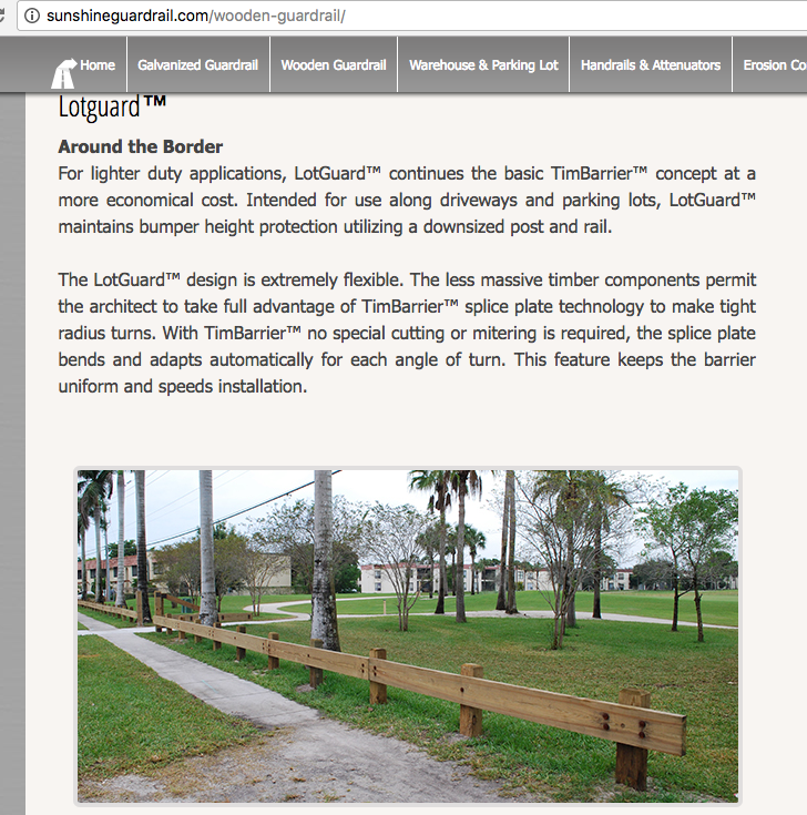
 “(1) The Board acted to ask the City to replace the guardrails with boulders without first informing the membership or neighborhood about the issue. And, (2) Although the initial request to the Board by residents was only about North Street, the letter expands the request to other streets along the Park, without notifying residents of the other streets.”
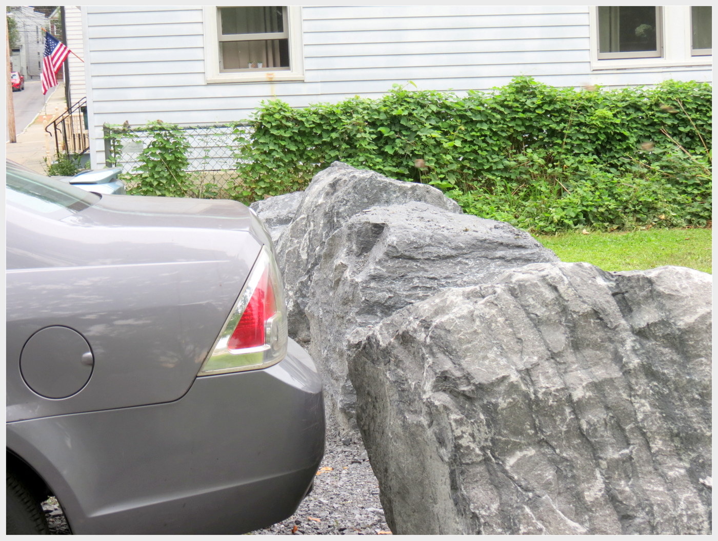


 CDPHP’s bike-share program, “CYCLE!”, has apparently been blessed with a trinity of factors that in this century and City most often create sacred cows: It is (1) championed by a political boss or Party; (2) paid for by someone else; and (3) acclaimed as “
 Maybe I should have added, or dropped a reassuring footnote, that my favorite Christmas present as a child was a red Schwinn bicycle that I used to escape our neighborhood and to deliver newspapers; that I bought another one while away at college; went to Plaine’s Bikes my first week living in Schenectady, almost 30 years ago, and got a hybrid mountain bike; and even in my 60s bought a used bike to enjoy with a friend who loved taking her small grandson on bike trails. Judging by the negative response of my Stockade neighbors, being a mere fan of leisure biking would not have tempered their reaction. What I got was a litany of platitudes about how “nice” the bike-share program is, how healthy cycling is, and how popular it is with younger generations.


 . .
. . 

 When presented months ago with the
  That is even more imperative when the Objectives stated in the SA
