
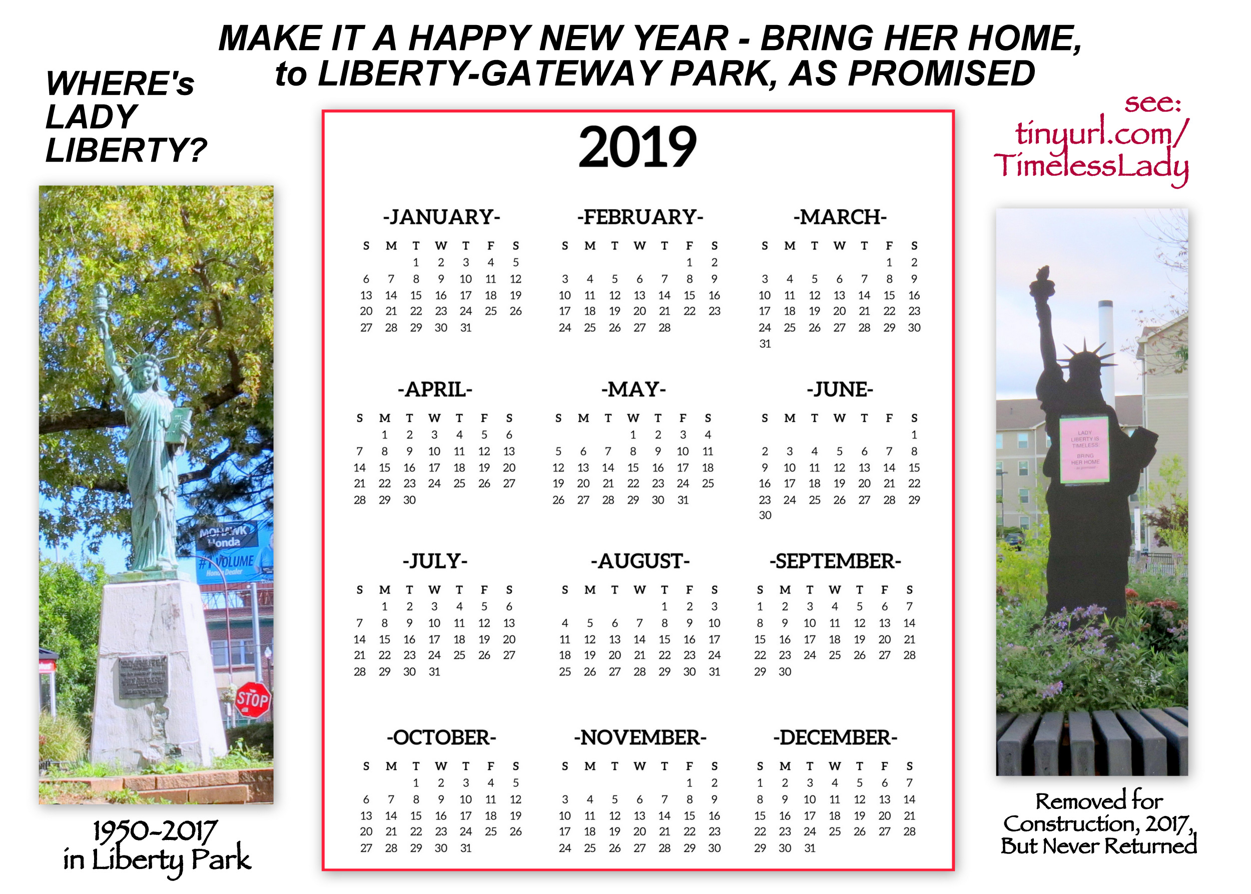
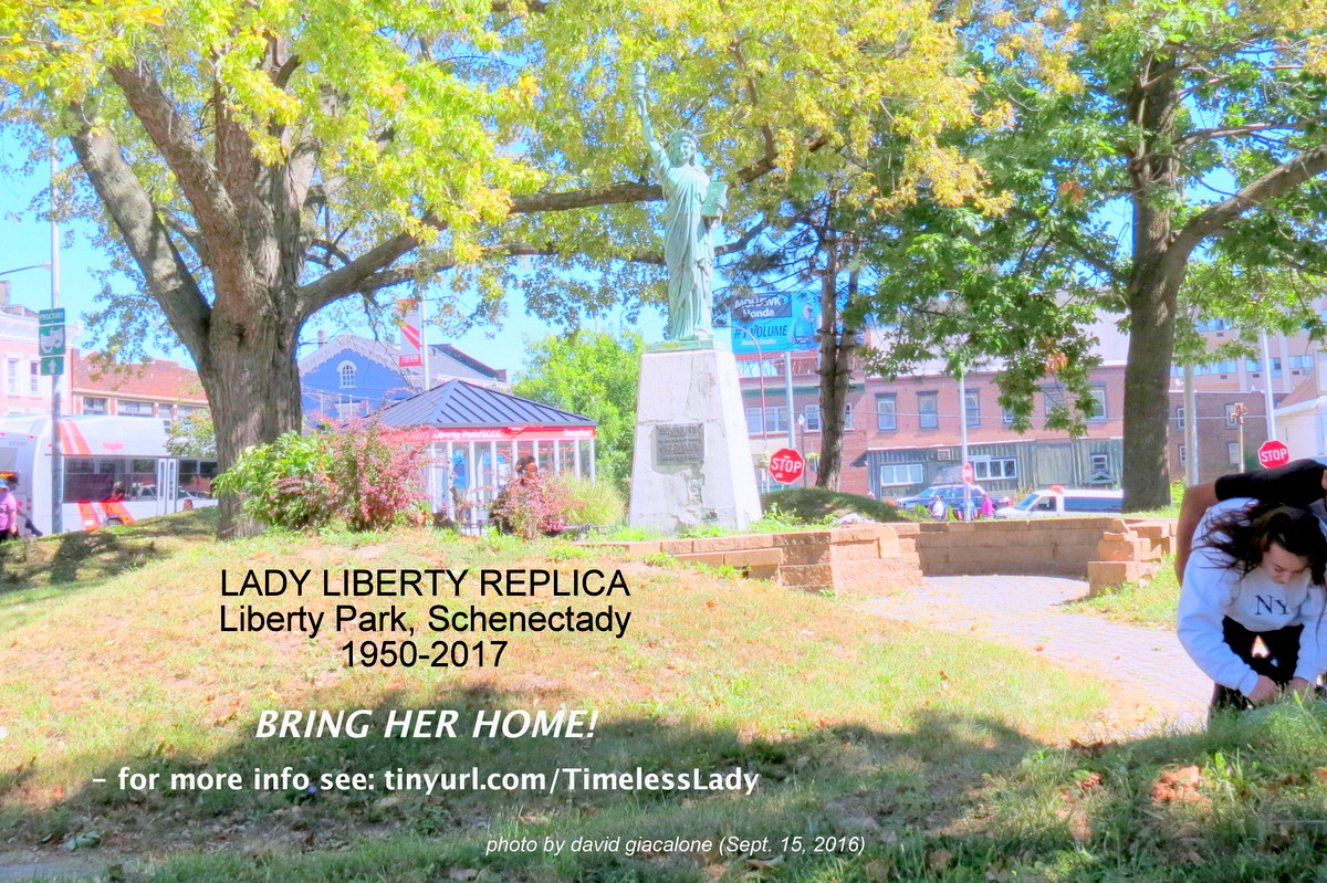
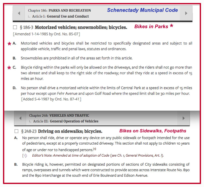
. . 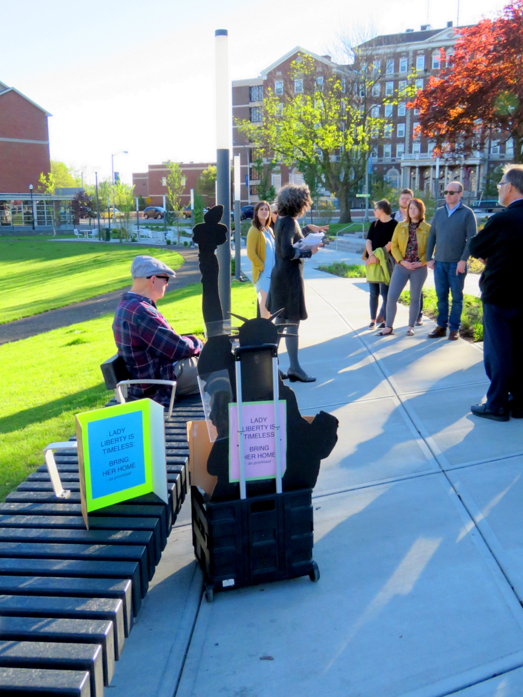
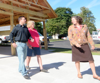
. . above: Lady Liberty and Mary Wallinger in silhouette during Plaza Tour . .

Mary Moore Wallinger
This past Thursday, May 16, 2019, the group LocalXDesign sponsored a Public Tour of Gateway Plaza in Schenectady, led by Mary Moore Wallinger, the chief designer and construction administrator for the Plaza, and the Chair of Schenectady’s Planning Commission. The public was invited to “Come and learn how the design evolved from concept to reality!”
Although very curious about the devolution of several important aspects of the Park/Plaza from the approved Gateway Plaza Implementation Plan (see our pre-Tour “plans evolve” post), the author of this posting decided to have a low-key display of protest, rather than shadowing Ms. Wallinger to pepper her with questions during the Tour. We therefore headed to the “central sculpture and seating display” at the upper, urban plaza portion of the Park, the approximate original location of Lady Liberty from 1950 to 2017.
 . . .
. . . 
. . above: images during the Tour at the “central sculpture display”; its base is still empty and could readily become the re-location/return spot for Lady Liberty, pleasing many residents and visitors, and saving the expense of purchasing a new sculpture . .
. . share this post with this short URL: https://tinyurl.com/WallingerExcuses
Nonetheless, I did hear two relevant comments by Ms. Wallinger, one prior to and one after moving to the upper portion of the Plaza. Here are the two telling remarks by Ms. Wallinger:
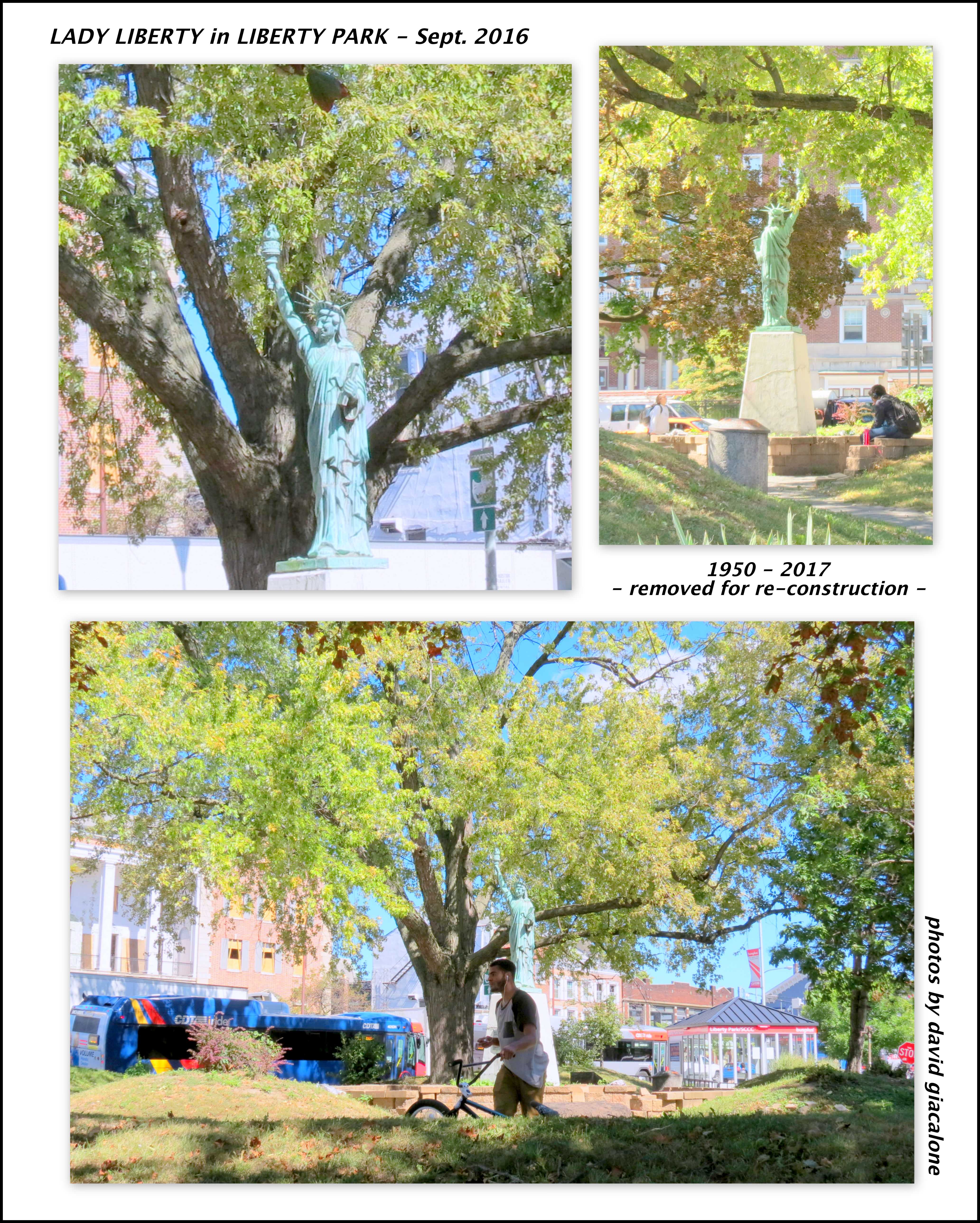
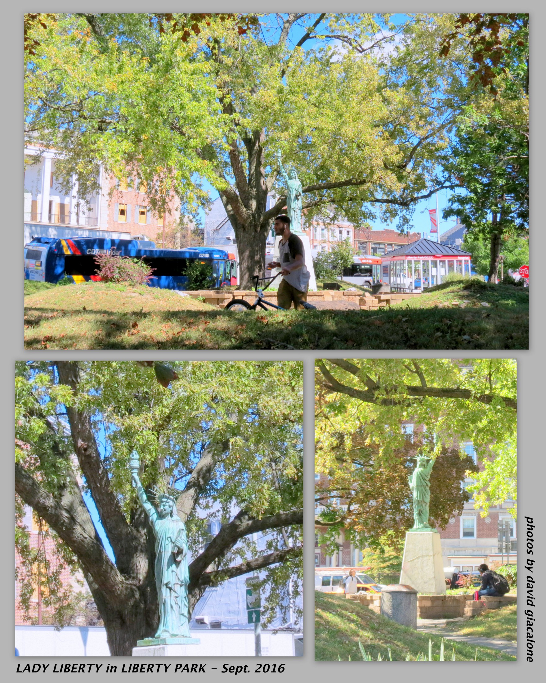
 The Beer-Drinker Anecdote. Mary, early in her Tour presentation, told her audience just how dreadfully designed, over-vegetated and unsafe Liberty Park had been prior to its reconstruction [click on image to the right for photos taken September 2016, before the reconstruction started]. It seems that in 2015, Mary was at the old Park, taking photographs, when an apparently inebriated beer-drinker rose up from the vegetation to ask what she was doing. She told him she was the designer of the new Plaza, and he said he liked the privacy of all the bushes and trees. The beer-drinker then asked if he could make some recommendations. Mary’s reply was: No, we already have an approved Plan, so we can’t make changes. [paraphrased] Ms. Wallinger did not seem to see the irony of that statement, at least from the perspective of those protesting her significant changes to the approved Plan. ……………………………………………………….
- The REPLICA EXCUSE: When the Tour group was approaching the upper plaza, someone must have asked Ms. Wallinger about the protestors or the missing Lady Liberty, or she simply felt the need to comment. I heard Mary speak dismissively of the significance of any dissent to her change in the Plan. Then, to justify the absence of the Statue, Mary added what was to me a new excuse for the exile of Lady Liberty. To paraphrase her explanation:
This Plaza is meant to welcome people to Schenectady and to symbolize its future. As a replica, the Statue of Lady Liberty is not an appropriate sculpture, given the location and purpose. The piece should be something original.
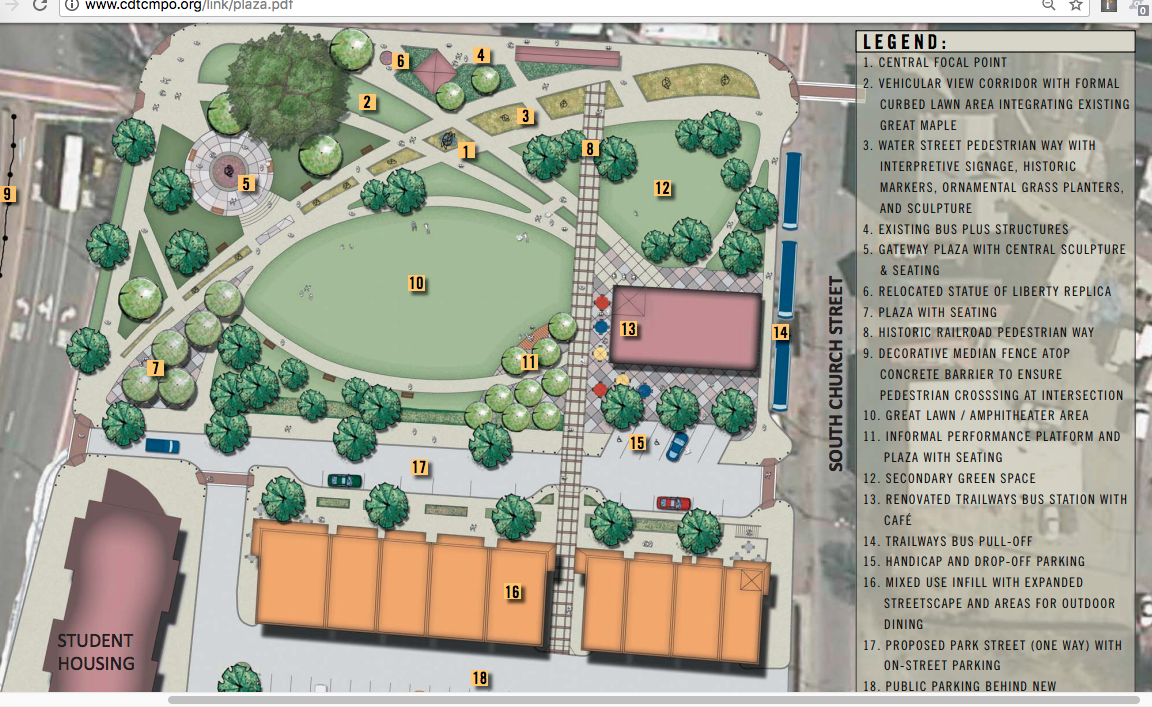
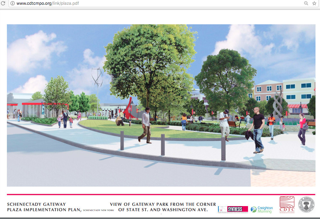
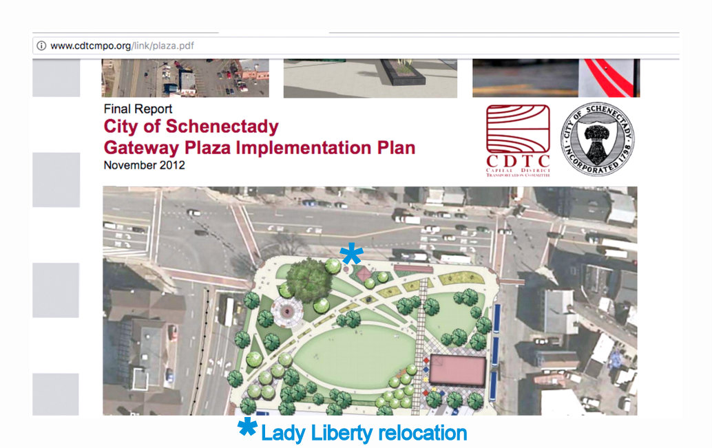
. . see #6 in Plan Legend, “Relocated Statue of Liberty Replica”. .
 Of course, I am not a certified urban planner, nor a (landscape)architect. But, I do wonder whether this No Replica Principle is widely accepted within the professional planning and design community, much less that it has been embraced by the American public. Our Lady Liberty Replica was known to be a replica, and called a replica, at the time Ms. Wallinger and her colleagues placed her in sketches, legends and renderings of the proposed Gateway Plaza. (for example, see image above this paragraph, and detail at left). This is surely not a situation where someone might confuse Schenectady’s 110″-high replica with the original Statue of Liberty. Like an adolescent who keeps adding (weak) explanations and excuses to justify a misdeed, Ms. Wallinger becomes less and less credible and trustworthy with each excuse.
By The Way, as for authenticity:
 A rendering of the proposed Pedestrian Walkway used in the Final Gateway Plaza Implementation Plan (and in prior drafts) shows what I assume is a replica of Venus de Milo, and not the original, in Gateway Plaza. (See detail to Left.)
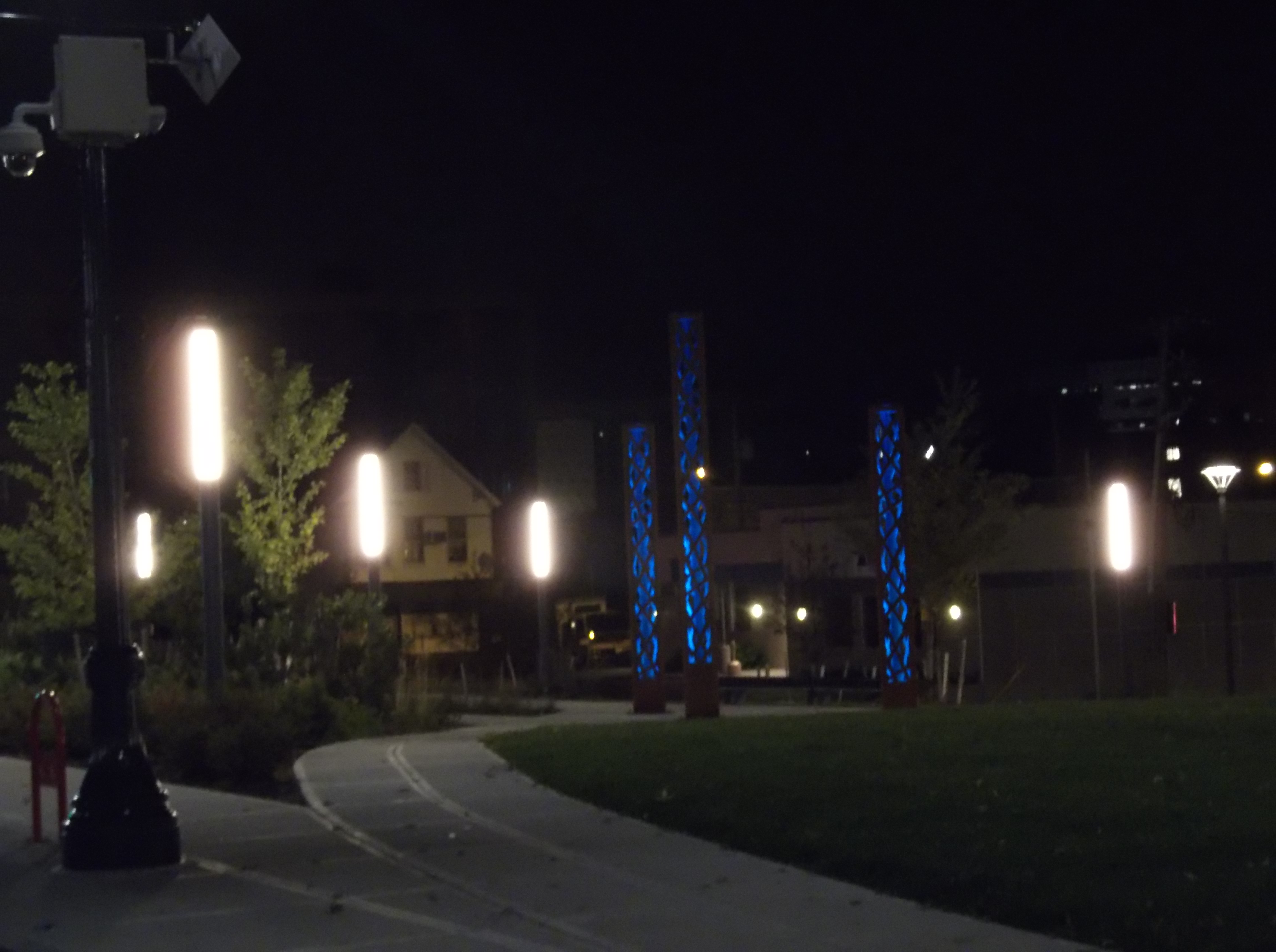
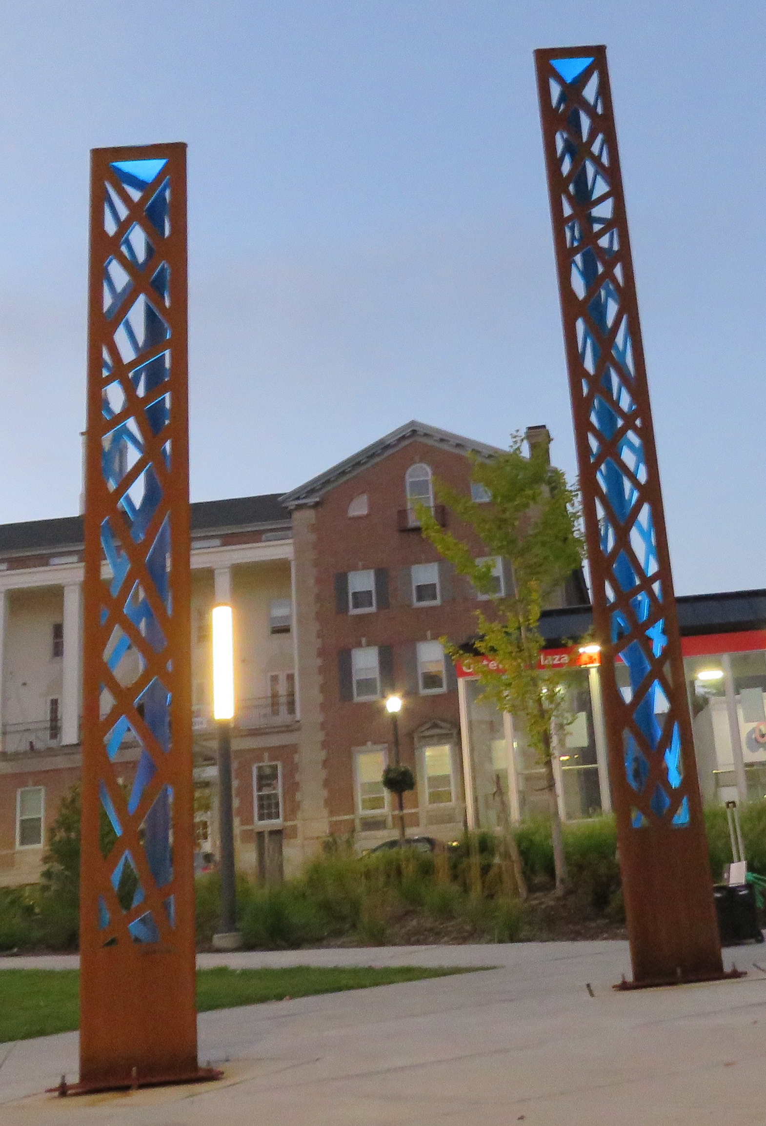
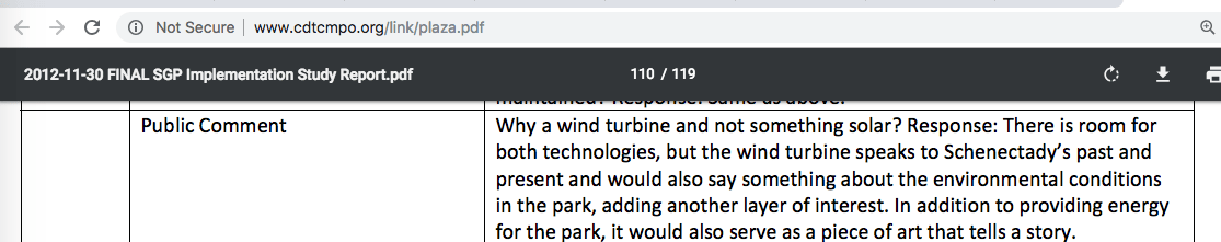
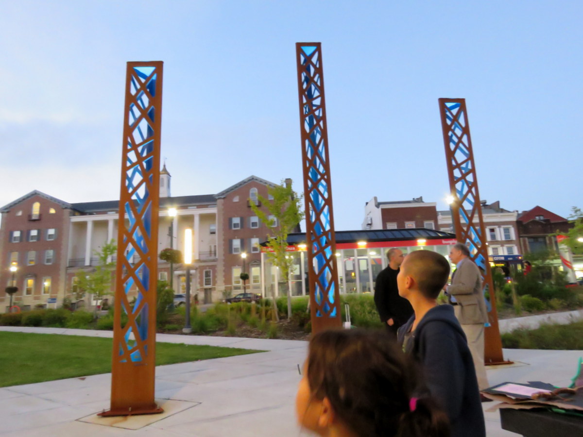
 More apt, Mary Wallinger is the designer who waxed poetic about the symbolism and “story” to be told by a proposed Wind Turbine sculpture to be used at the Central Focal Point of Gateway Plaza – a reference to our historic technological innovations, future accomplishments, and ecological aspirations. Instead, with no chance for public input, she gave us as “modern urban sculpture”, three Cor-ten, fast-rusting, off-the-shelf pillars/girders, which do not seem to tell a story, but (intentionally or not) many folks in Schenectady believe may have been part of the destroyed World Trade Center towers. (see our post “pillaried at the Plaza“)


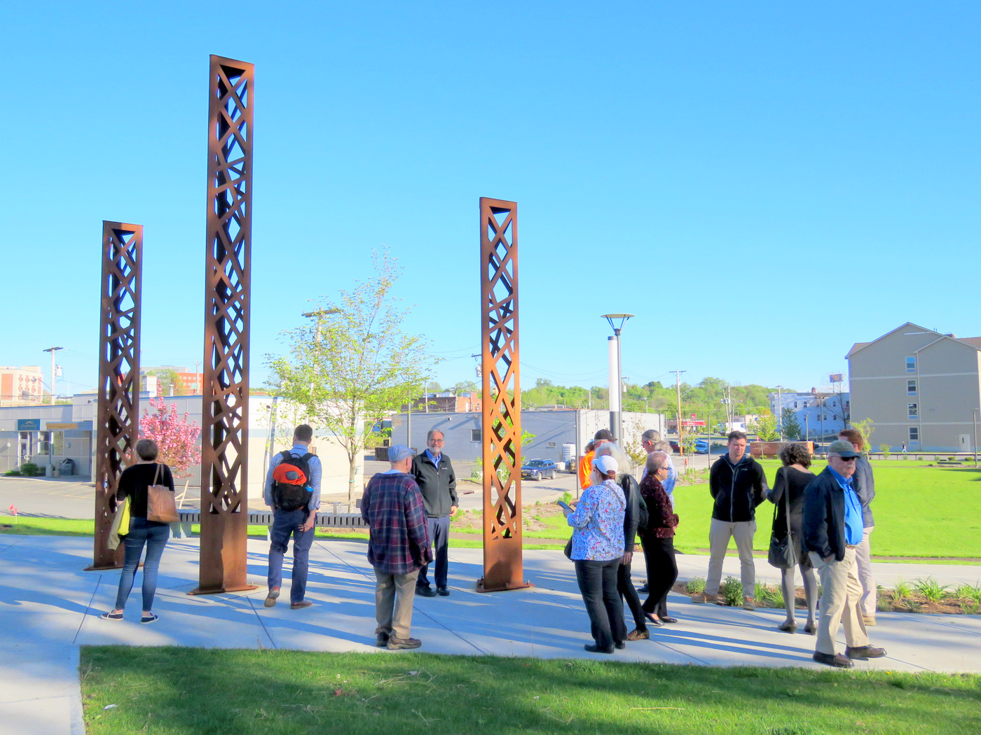
. . above: Tour group at the Plaza’s “urban sculpture” focal point . .
CRITERIA for CHANGING APPROVED PLAN? Of course, the biggest absence to date in the “explanations” from Mary Moore Wallinger, as both a prolific designer and Chair of the City Planning Commission, is any acknowledgement that there is a difference between plans changing from earliest concepts through drafts, steering committee sessions, and public workshops, and changes after official resolution and approval of a Final Plan by the City Council and Mayor.
By The Way, Resolution No. 2013-206, approved by City Council on Aug. 12, 2013 (and by Mayor Gary R. McCarthy, on Aug. 14, 2013), stated (emphases added):
WHEREAS, three public meetings of this plan and a public presentation to the City Council have been held, and changes to the plan were made based on comments received:
NOW, THEREFORE BE IT
RESOLVED, that the City of Schenectady adopts, as an official document, the “Gateway Plaza Implementation Plan”.
 Moreover, there is no indication from Mary Wallinger as designer or as Planning Chair, as to what the standard should be for changing a significant aspect of a “Final Plan” adopted after the formal planning process is completed. We also wonder what role renderings are meant to play that are submitted during the planning process and as part of a final draft. [viz., Are they in reality meant to mislead, calm, and disarm those in favor of preserving some aspect of the location?] From years of observation, such changes are “justified” by citing engineering reports that claim serious safety or financial difficulties, necessitating varying from an approved plan; changes in a designer’s stylistic preferences do not warrant such changes.
- Procedure for Alterations? Another important question, of course, is what the procedure should be for making any such changes after an implementation plan has final City approval. For example, what is the role of the “construction administrator”, Planning Department, Mayor, and/or City Council? What process is appropriate when there are no deadline pressures?
 One More (Major) Irony: Before I list the excuses given by Mary Wallinger for her refusal to return Lady Liberty to Liberty Park, there is one major ironic coincidence to mention about last week’s Tour of Gateway Plaza: The Grand Opening of the Statue of Liberty Museum took place earlier that very day on Liberty Island. That’s right, despite claims to the contrary, Lady Liberty is so relevant to present-day America and its future, that $100 million was spent to create this museum that explores and celebrates the meaning of the Statue of Liberty. See “What does Lady Liberty stand for? A look at changing attitudes” (Christian Science Monitor, May 16, 2019, by Harry Bruinius)
- “Liberty Enlightening the World”. By the way, our Mayor and Planning Chair are quite enamored with the notion of a Renaissance in Schenectady. They could do worse than remembering that, beyond craft beer, mediocre façades, revolving restaurants, and the casino of their “renaissance”, our City could use more stress on culture and Enlightenment. The Liberty Statue in New York Harbor was named “Liberty Enlightening the World” by its creator. One commentator had this to say in contrasting Renaissance and Enlightenment political philosophy:
The political philosophy of the Enlightenment is the unambiguous antecedent of modern Western liberalism: secular, pluralistic, rule-of-law-based, with an emphasis on individual rights and freedoms. Note that none of this was really present in the Renaissance, when it was still widely assumed that kings were essentially ordained by God, that monarchy was the natural order of things and that monarchs were not subject to the laws of ordinary men, and that the ruled were not citizens but subjects.
. . . It was the Enlightenment, and thinkers who embodied its ideas, like Voltaire and Benjamin Franklin, who were the intellectual force behind the American Revolution and the French Revolution, and who really inspired the ideas behind the great political documents of the age like the American Declaration of Independence and the French Declaration of the Rights of Man and the Citizen.
In this context, Lady Liberty seems, to most of us, an excellent symbol and reminder of our past, and bridge from our present to our future.

WHY EXILE LADY LIBERTY from HER PARK?
Below are the reasons that Mary Moore Wallinger has given for her feigned change of heart in refusing to return the Replica of Lady Liberty to the expanded Liberty Park, a/k/a Gateway Plaza. Many of us believe that none of these excuses would have been accepted — and most would have been ridiculed, or at least soundly defeated on the merits — during the actual planning process for Gateway Plaza. That might be why Ms. Wallinger never raised them at the time.
 . . too small? of course not.
 The STATUE IS TOO SMALL, so that the Statue would be overwhelmed in the big Plaza. This was the reason that Mary told me in an email, when I first asked why Lady Liberty was not returning to Her Park. [Response: She’s not too small in the scale rendering done for the Implementation Plan (see detail at right from this rendering). In addition, Lawrence the Indian is almost three feet shorter and commands his Circle, as is Thomas Edison down at Erie Blvd. and S. Ferry. An experienced landscaper should be able to create a niche for the Lady somewhere at this large Plaza, honoring Her, without creating a space that is too-enclosed for safety.]
- “PLANS CHANGE“: In defending her wish to keep Lady Liberty out of the new Plaza and to send Her to Steinmetz Park instead, Mary told the City Council Meeting of March 26, 2018 that “Plans change,” giving the example that the design team had originally planned to have a road going through the Park. As discussed above, this justification for failing to return Lady Liberty ignores the distinction between the many stages of an open-minded planning process and the decision to change, without public input or return to City Council, a major aspect of a Final Plan that has been through public workshops and approval by the City Council. Neither Mary Wallinger nor the Mayor claimed any safety or engineering issues for not returning Lady Liberty. (The presentations “from the floor” to the March 26, 2018 City Council Meeting are discussed more fully in the posting “Lady Liberty is Timeless“.)
- NOT SIGNIFICANT PART of the PLAZA PLAN
- Mary told this to the City Council the evening she appeared to support sending Lady Liberty to the Veterans Memorial planned for Steinmetz Park. Response: Mary is confusing square footage with significance, and overlooking both common sense and the clearly stated preference of the public for the Lady’s return. Returning Lady Liberty was fully supported by all commenters in the Public Workshop. As the Gazette reporter who attended the Public Workshops wrote on June 13, 2013:
- “Residents . . expressed a strong desire to keep the park’s identity in line with its name: Liberty. The Lady Liberty replica has sat on its pedestal in the park for 62 years would still remain. But it would likely move closer to the State Street border.”
- Wallinger also told City Council that only a few members of the public took part in the Public Workshops, which she noted were held because the State requires them when funding is requested. Response: This is, for many obvious reasons, a scary argument for the Chair of our Planning Commission to make. Moreover, had Ms. Wallinger frankly advocated to replace Lady Liberty in the Park and send Her away, there certainly would have been a larger and more assertive public presence and outcry at the Public Workshops, and by City Council, the media, and the broader community.
- Mary told this to the City Council the evening she appeared to support sending Lady Liberty to the Veterans Memorial planned for Steinmetz Park. Response: Mary is confusing square footage with significance, and overlooking both common sense and the clearly stated preference of the public for the Lady’s return. Returning Lady Liberty was fully supported by all commenters in the Public Workshop. As the Gazette reporter who attended the Public Workshops wrote on June 13, 2013:
-

Cover of Final Plan
NOT IN THE EXECUTIVE SUMMARY. Ms. Wallinger, who surely drafted the Executive Summary, noted in passing to City Council that Lady Liberty was not mentioned in the Executive Summary of the Final Implementation Plan. Given placement of Lady Liberty in renderings submitted with the Final Plan, and on the Cover of the Final Plan (see annotated image at left), its mention in the text of the Plan, the cost projections, and explicit discussion of the Return in the public workshop, leaving Her out of the Executive Summary may well have been an intentional action, perhaps meant to foreshadow and excuse the future exile of Lady Liberty.
-

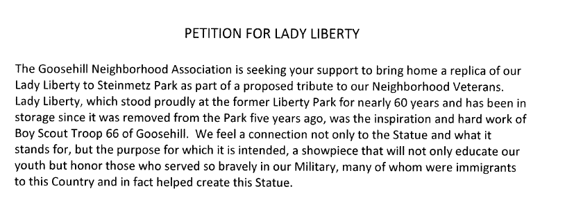
Goose Hill Petition
NEGLECTED FOR FIVE YEARS in STORAGE. Mary Wallinger did not make this argument directly, but she let her friends and allies on Goose Hill make the argument in March 2018, and put it in their petition to City Council and the Mayor, seeking to have Lady Liberty sent to Steinmetz Park for a Veterans Memorial. Wallinger never corrected this misinformation, and did not advise City Council of the erroneous claim. As administrator of the construction plan at Gateway Plaza, Ms. Wallinger was well aware that Lady Liberty was not removed from Liberty Park until August 2017, and only to protect the statue during construction.
- NOT CONTEMPORARY ENOUGH
 to fit in with the intended style of the new Plaza, which she insists is meant to “celebrate the future” of Schenectady. [Response: (1) That formulation truncates the original goal written by Wallinger in the Implementation Plan: the Plaza will “celebrate the past, present, and future” of Schenectady. And, (2) One is hard-pressed to find a “style” of design at the Plaza, and the well-known and beloved appearance of Lady Liberty might take the edge off the mood set by rusty girders and light-sabers. In general, urban design that tries to seem contemporary often seems merely “temporary” and quickly dated.]
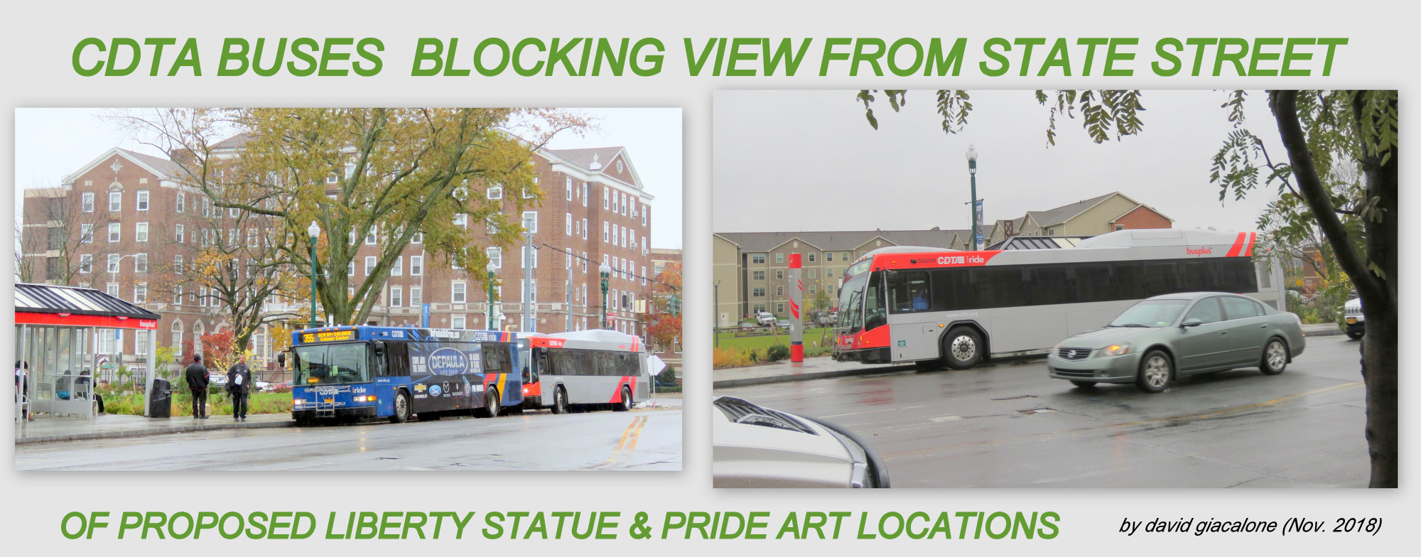
  “SHE’D LOOK LIKE SHE’s CATCHING a BUS”. [Response: This flippant remark to a reporter is from the designer/planner who chose the relocation spot for Lady Liberty next to the bus stop, and (see image to right) insisted the Statue would seem grander there and have more exposure. At this website, we worried that CDTA buses would line up blocking out the view of Lady Liberty from State Street much of the day — another reason to return Her to her original location in the Park, now called the Central Sculpture Area].
 The STATUE is VERY DAMAGED, VERY EXPENSIVE to REPAIR. Response: This damage and expense were not mentioned until months after the decision to send the Lady elsewhere was made (she looked pretty good next to Director of Planning Diotte, in photo to left). Also, there has been no description of the damage, or apparent action to get an estimate, much less get it repaired and back in public view. Some of the expense should have been part of the original Plaza budget (which did show a $20,000 expense for relocating the Lady Libery within the Plaza, since the statue and base would have been slated for at least refurbishing, if Ms. Wallinger ever planned to return the Lady to Liberty Park. Also, the money saved by not buying a new sculpture for the Main Sculpture location should go toward any needed repair, followed by placing Lady Liberty at the main sculpture spot, approximating her original location.
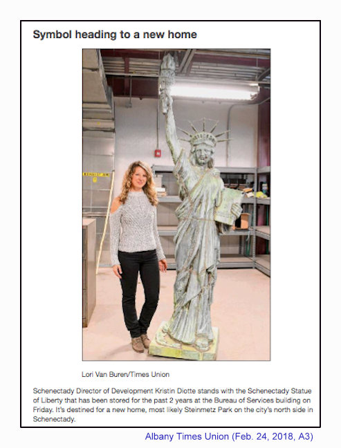
 IT’s THE MAYOR’s DECISION, Not MINE: Response: Of course, the Mayor (or a City Council with backbone, or a court) can try to settle this, but there is no doubt that it was Mary Moore Wallinger who has spearheaded the notion of not returning the Lady. Mary’s failure to take responsibility suggests how weak the many arguments are underpinning her subjective desire to exile the Lady for Wallinger Plaza in secret, and echoes her complaint to me that I was making her look like the “bad guy”. On the other hand, there is little doubt that Mary Wallinger, as the Mayor’s “Design Team” and his much-needed partner moving projects through the Planning Commission, could successfully lobby the Mayor to follow the approved Implementation Plan and return the Lady to Her Home, Liberty Park at Gateway Plaza.
- [Surprise,] IT’S A REPLICA: [scroll back up this posting for commentary on this sad excuse for an excuse.]


A Final Thought: The UTICA EXAMPLE:
 . .
. . 
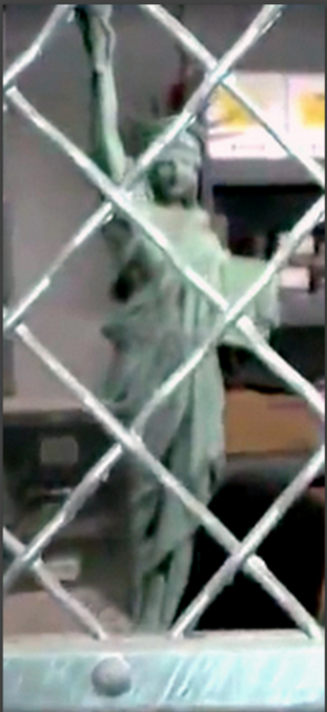
. . above: [L] Schenectady’s Liberty Replica in warehouse storage room since August 2017; [R] Utica’s Liberty Replica in a workshop where She was fully restored, June 2017
Our neighboring upstate City, Utica, New York, also received a replica of Lady Liberty in 1950, thanks to their local Boy Scouts. It is apparently two feet shorter than Schenectady’s and had deteriorated badly. Nonetheless, thoughtful people of Utica decided to pay for a complete restoration of their Liberty Replica (with donations to cover the $10,000 expense), to reestablish its grand presence on their Monument Parkway. See the May 17, 2017 Newsletter of the Central New York Conservancy.


. . above: Utica’s Lady Liberty at Monument Park [L] before and [R] after the restoration by Michael H. Mancini, MHM, Inc., of St. Johnsville . .
- Thank you for the heads-up from Gerald Plante, who featured Utica’s Lady Liberty replica at his Facebook Page, where he frequently advocates for the return of Schenectady’s Lady.
 follow-up (Feb. 11, 2021): Please see our posting “Will civic pride save Schenectady’s Liberty replica“, arguing that our Replica has over a hundred sister 1950 BSA statues extant and located in more appropriate locations, and showing the superior treatment of the BSA Liberty statues at each of the five other NYS locations.
 . . mistreated


 Even worse, as with the name of Liberty Park, City Council doesn’t even bring these measures up again, letting the Mayor’s Office or Metroplex just go ahead with the changed plans, and getting the media to go along.
 Follow-up (Jan. 23, 2019): According to an email I received from Gazette reporter Andrew Beame, City Hall is arguing that


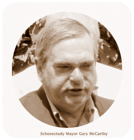
 In Schenectady, approved plans have been changed on projects for preserving or replacing buildings at important locations — usually, with City Hall or the Planning Commission pointing to “engineering” reports that they say indicate a safety issue or unknown factors that make the approved plans impossible, impractical, or immensely more expensive, to achieve. No such reasons were available for the belated exiling of Lady Liberty from Liberty Park and its extension into Gateway Plaza. Instead, Mayor Gary McCarthy spoke of recommendations from “the Design Team,” giving no further details or explanation. The Design Team is, or is headed by, Mary Wallinger.


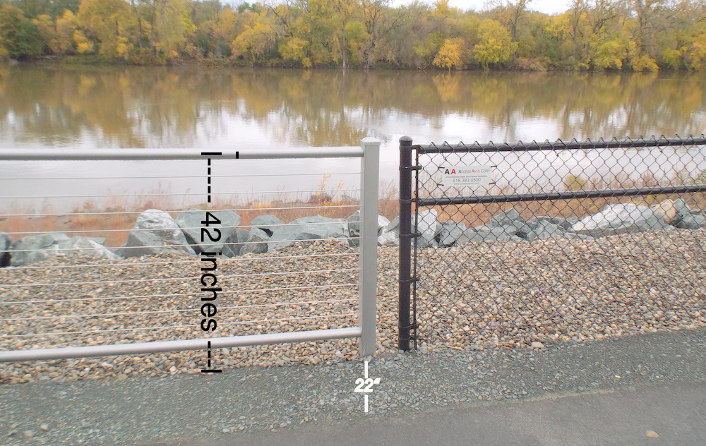


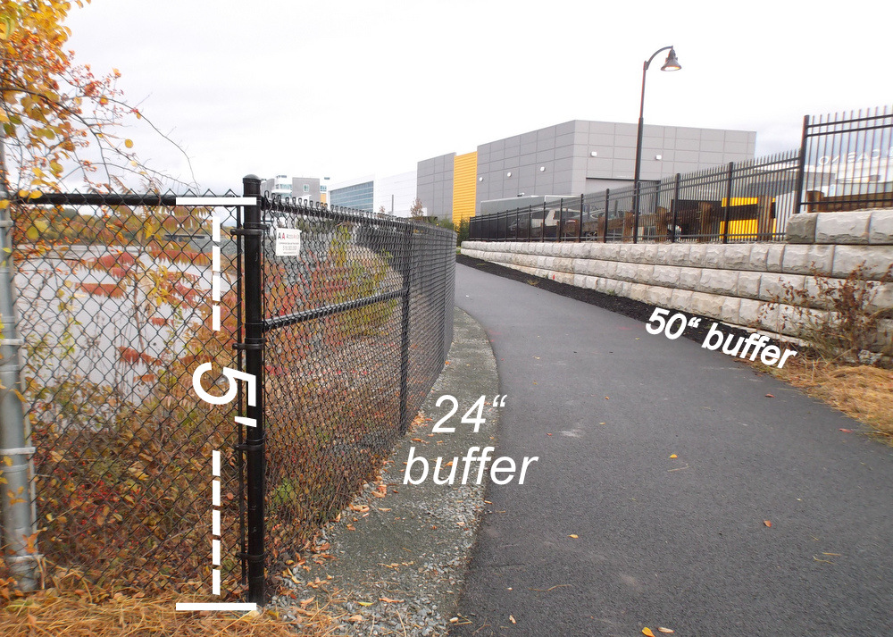
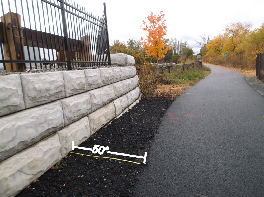

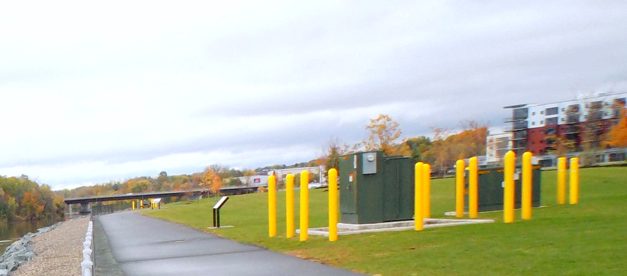
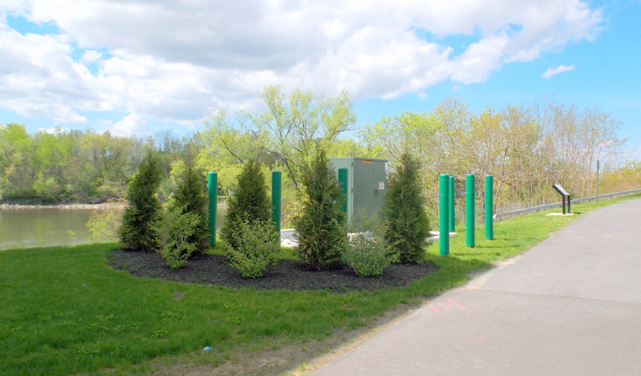
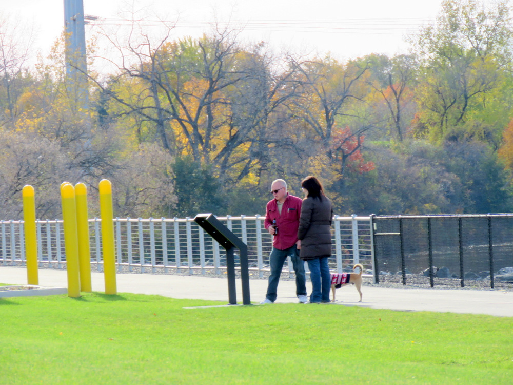
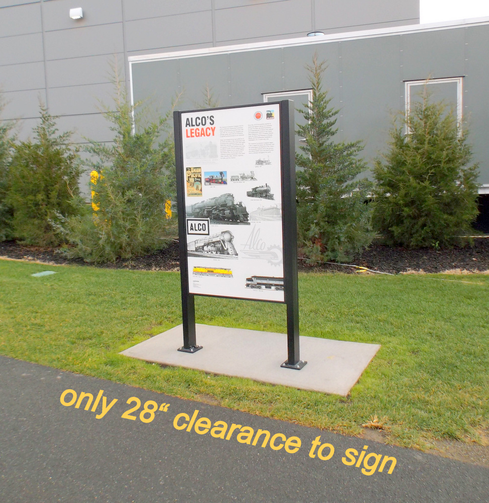
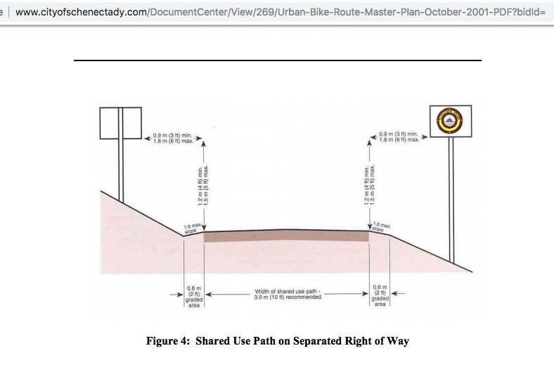
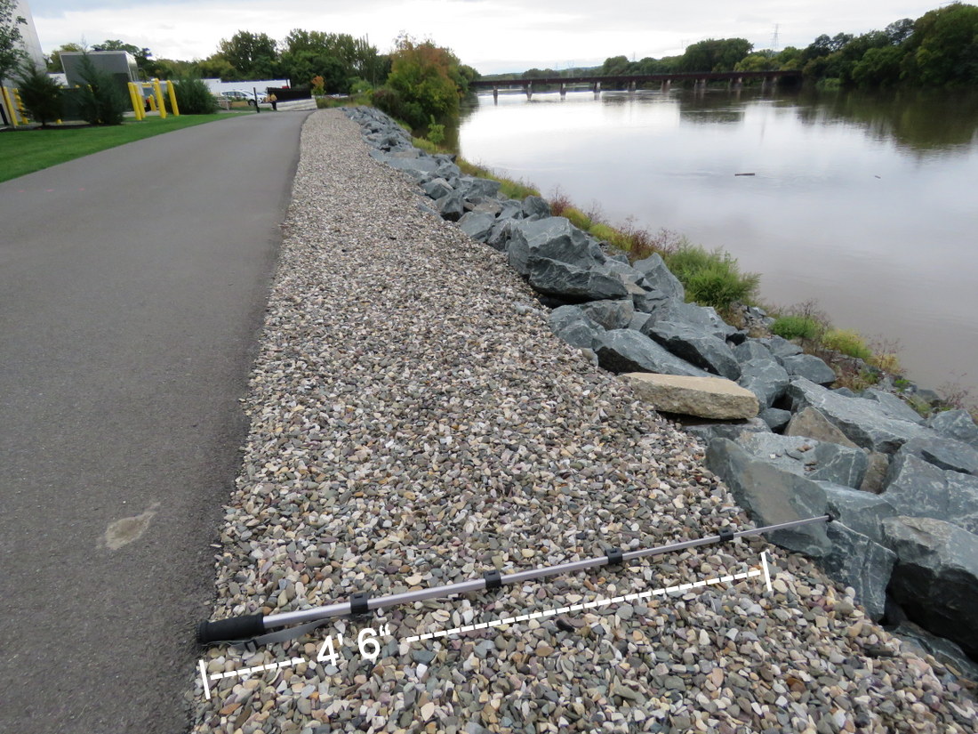
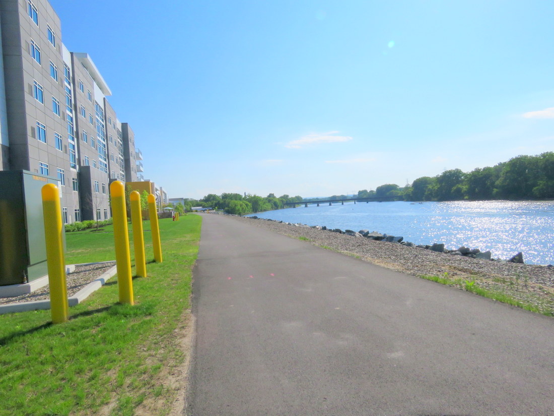
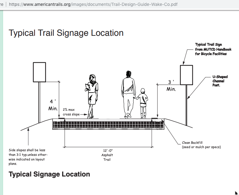
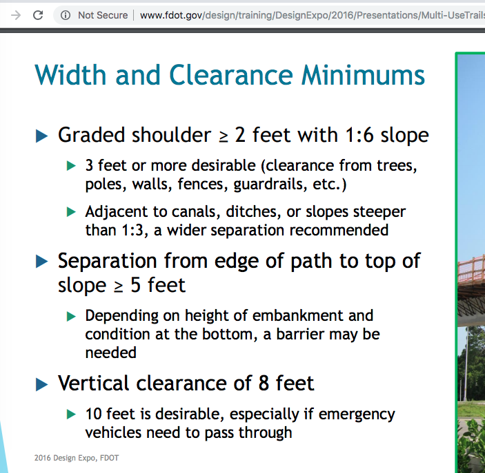
 Below is an email message that I sent today (October 15, 2018) to Christine Primiano, the City of Schenectady’s Chief Staff Planner. It outlines why I believe we must halt the installation of a railing/fence along the riverside of the ALCO Heritage Trail in Mohawk Harbor, and seek to achieve a better, safer guardrail. The 42″ high guardrail is being installed only two feet from the paved edge of the Hike-Bike Trail. Best practices for shared-use paths and relevant regulations call for a 3-foot buffer (including the Bike Schenectady Master Plan adopted just last year). A taller guardrail, with a rub rail, is also needed. Following the regulations and guidelines can help increase the likelihood that hikers, cyclists, tourists and other visitors will avoid injury along the Mohawk Harbor trail and guardrail, and reduce liability exposure by the City and County.


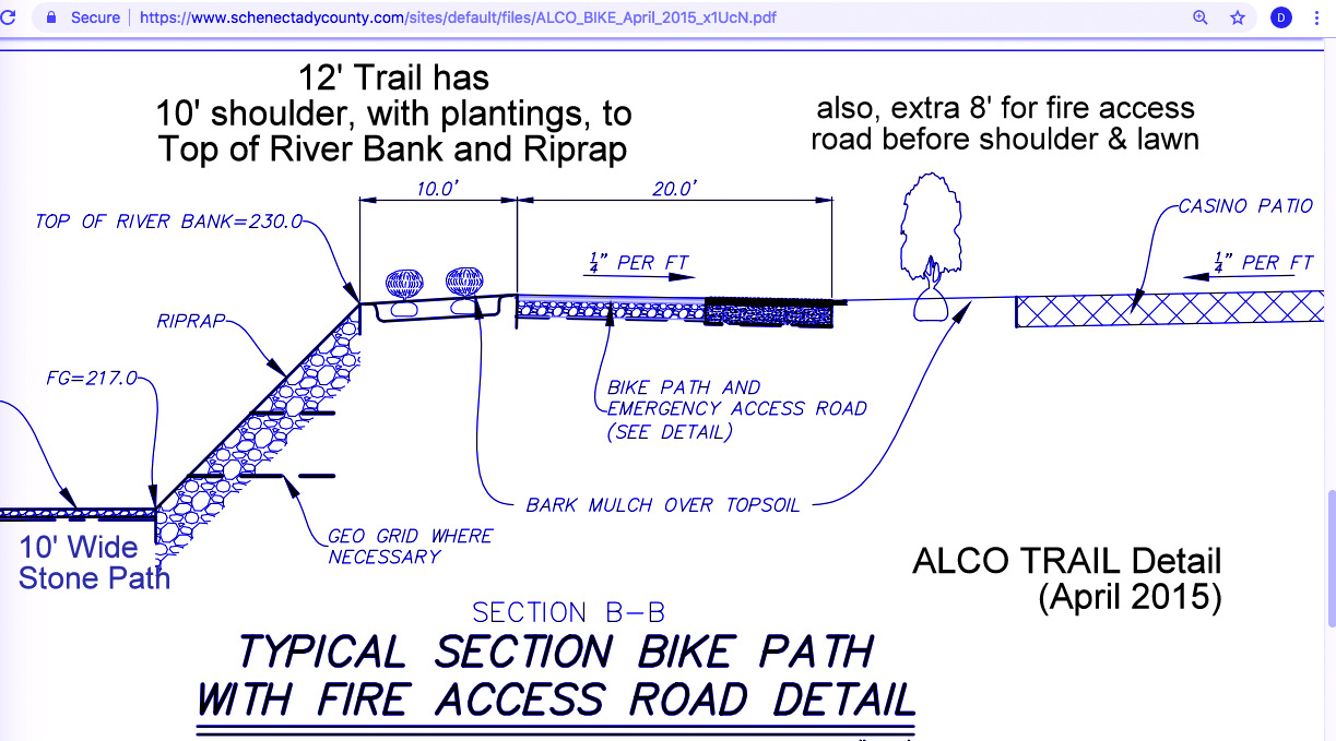


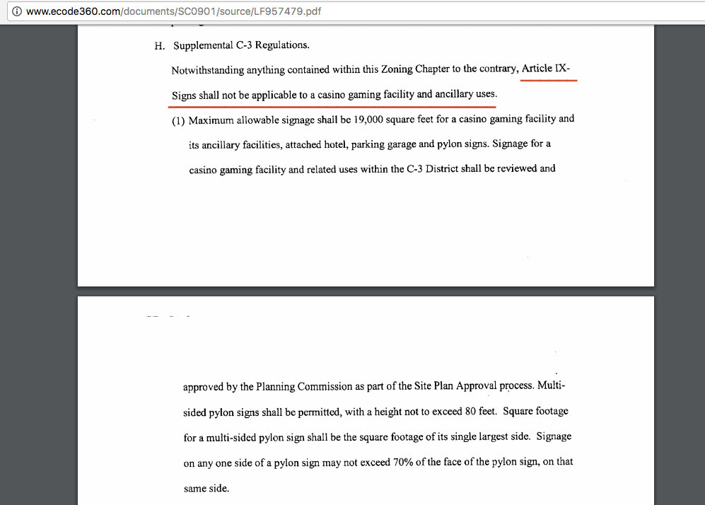
 In addition to the points made in the email to the Planning Office, I continue to wonder why taxpayers are paying 90% of the cost of constructing the bike-hike trail, and for the guardrail, when the Schenectady Zoning Code for the Harbor District [C-3, §264-14(1)E(4)] says that: “A single multi-use pedestrian and bicycle trail shall be constructed by the applicant.” “Applicant” refers to the developer or owner of the harbor property.

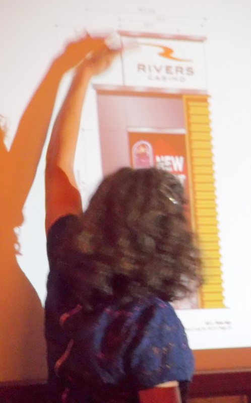
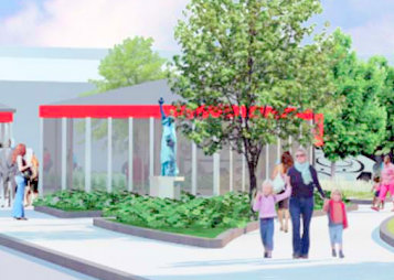
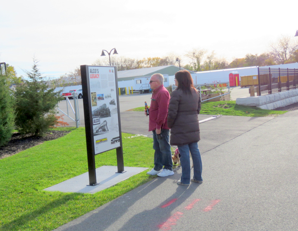
 . . experience Downtown Schenectady’s newest public space, Gateway Plaza. Enjoy live music, food & craft beer vendors, and family art activities in this beautiful new destination at State Street and Washington Avenue at the western gateway to downtown. Free and open to the public.


 follow-up (January 16, 2020): Should taxpayers or the developer of Mohawk Harbor and the Rivers Casino pay for a large-vessel dock at Mohawk Harbor? Please consider:


 . . .
. . . 

 (Oct. 5, 2018): Ray Gillen wrote in an email to the editor of this weblog, in the third week of September, that a fence would be built along the trail buffer “in October.” As of noon October 5, there is neither a fence or guardrail and no temporary warning devices; see the photo below, taken today:
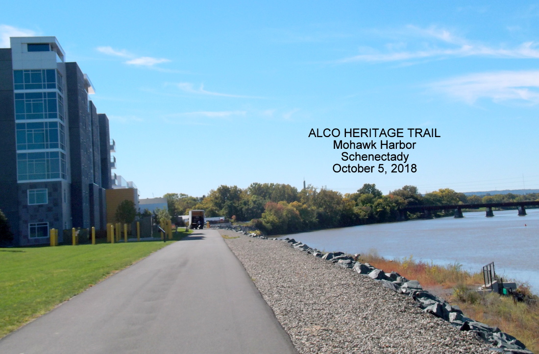


 $$? FINANCING THE TRAIL: The County will pay all expenses above $100,000. The City of Schenectady C-3 Waterfront District zoning code, as quoted above, states that the pedestrian and bicycle trail “shall be constructed by the applicant.” (emphasis added)

 . .
. . 

 . . For our response to the new location In Exile assigned to Lady Liberty in late August 2019, see “
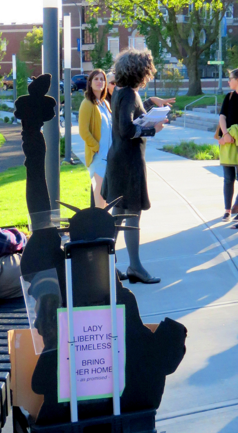


 update (Feb. 21, 2019):
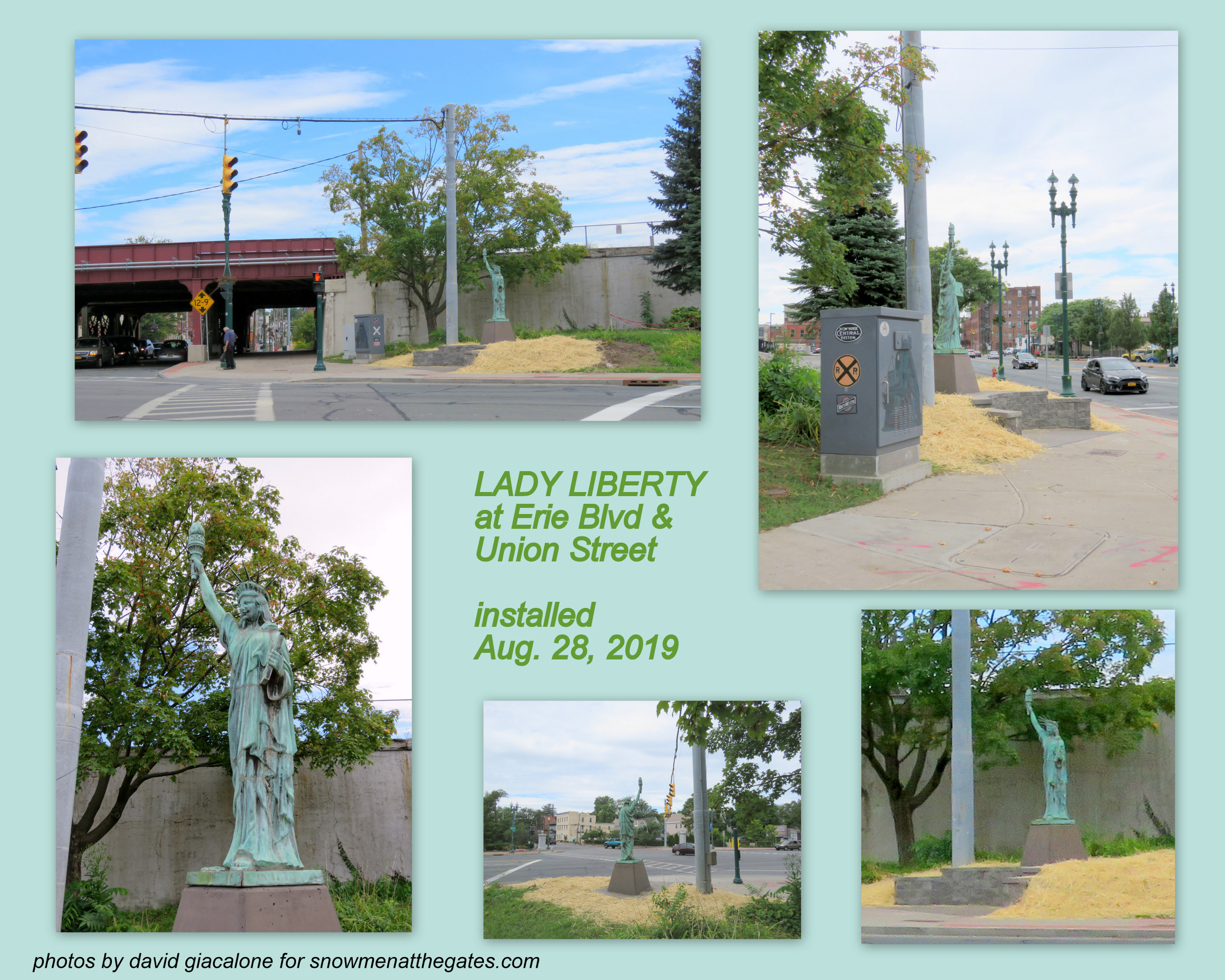
 Zoning Board Chairman James Gleason said the application was modified from the one the board rejected on Oct. 4, and the board collectively determined the variance was not significant. Board members who opposed the sign in October were primarily concerned about its size, according to meeting minutes.
 Motion by Mr. Keller, seconded by Ms. D’Alessandro-Gilmore, to approve the Area Variances based on the following findings of fact:
 It is difficult to quantify “substantiality.” The board should, however, make a reasoned judgment as to


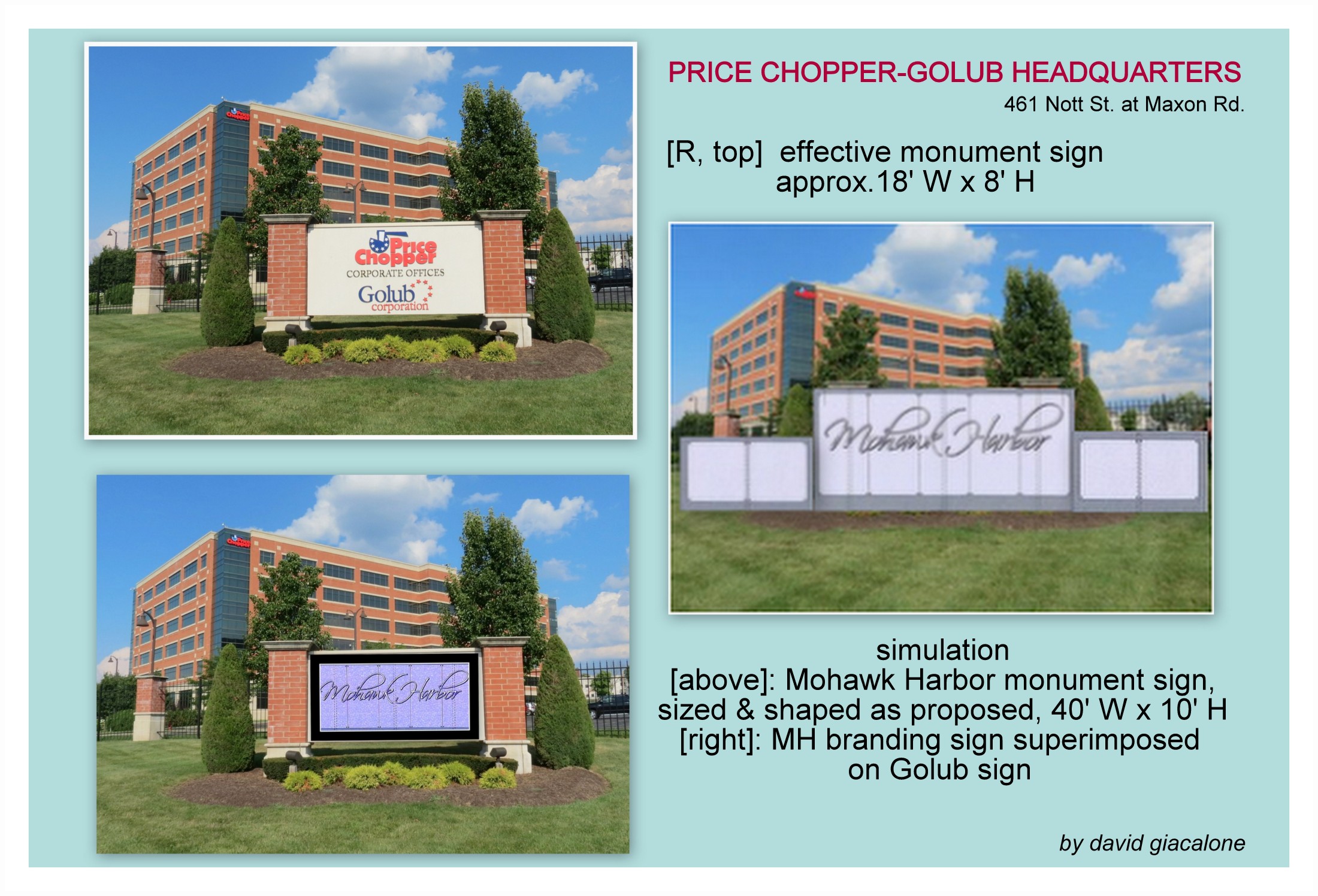
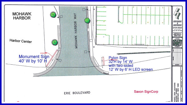
 BZA follow-up (November 16, 2017): Click for a copy of
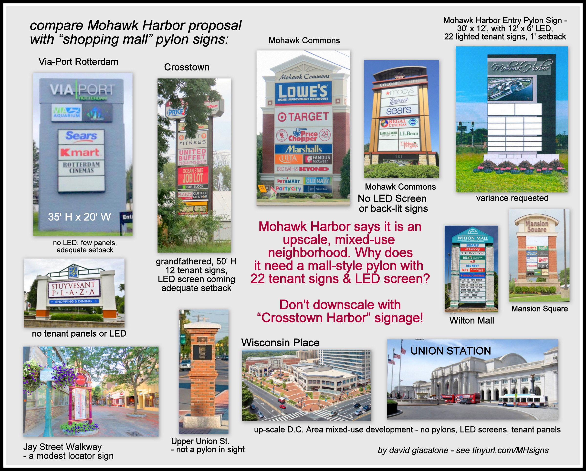
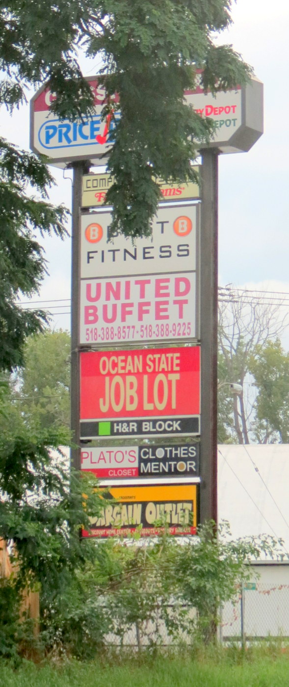
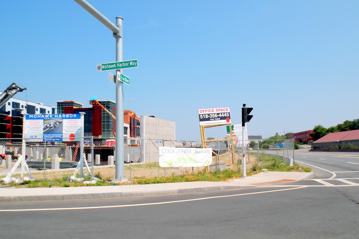
  Moreover, I learned late yesterday afternoon (Nov. 14), thanks to TU reporter Paul Nelson, that BZA had announced a special Meeting to be held tomorrow, November 16, in which Mohawk Harbor has resubmitted its previously rejected application for a 30′ pylon of 265 sq ft. The only difference is that it has given up asking for a 1′ setback instead of the required 3′ setback from the right of way.
  David Giacalone, proprietor of this website, stated that BZA should have made its own independent review of variance issues before the Planning Commission spent two months helping MH design a 30-foot sign for a 7-foot sign location. He also stressed that (1) Mohawk Harbor is asking for a shopping-mall-style sign despite touting the development as an upscale mixed-use residential and commercial neighborhood; he presented a


 . . .
. . .  For additional details, please see our
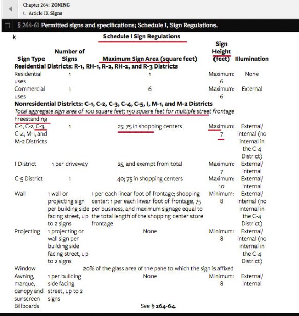


 It is the


 CDPHP’s bike-share program, “CYCLE!”, has apparently been blessed with a trinity of factors that in this century and City most often create sacred cows: It is (1) championed by a political boss or Party; (2) paid for by someone else; and (3) acclaimed as “
 Maybe I should have added, or dropped a reassuring footnote, that my favorite Christmas present as a child was a red Schwinn bicycle that I used to escape our neighborhood and to deliver newspapers; that I bought another one while away at college; went to Plaine’s Bikes my first week living in Schenectady, almost 30 years ago, and got a hybrid mountain bike; and even in my 60s bought a used bike to enjoy with a friend who loved taking her small grandson on bike trails. Judging by the negative response of my Stockade neighbors, being a mere fan of leisure biking would not have tempered their reaction. What I got was a litany of platitudes about how “nice” the bike-share program is, how healthy cycling is, and how popular it is with younger generations.


 . .
. . 

 When presented months ago with the
  That is even more imperative when the Objectives stated in the SA
